
experiences
See where we've explored!
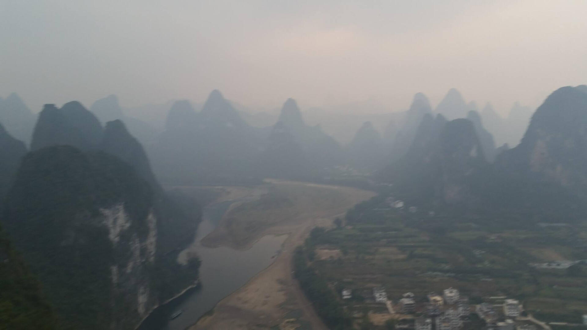
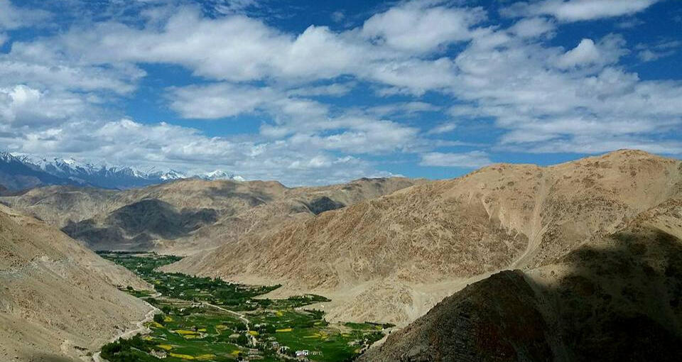
CHINA
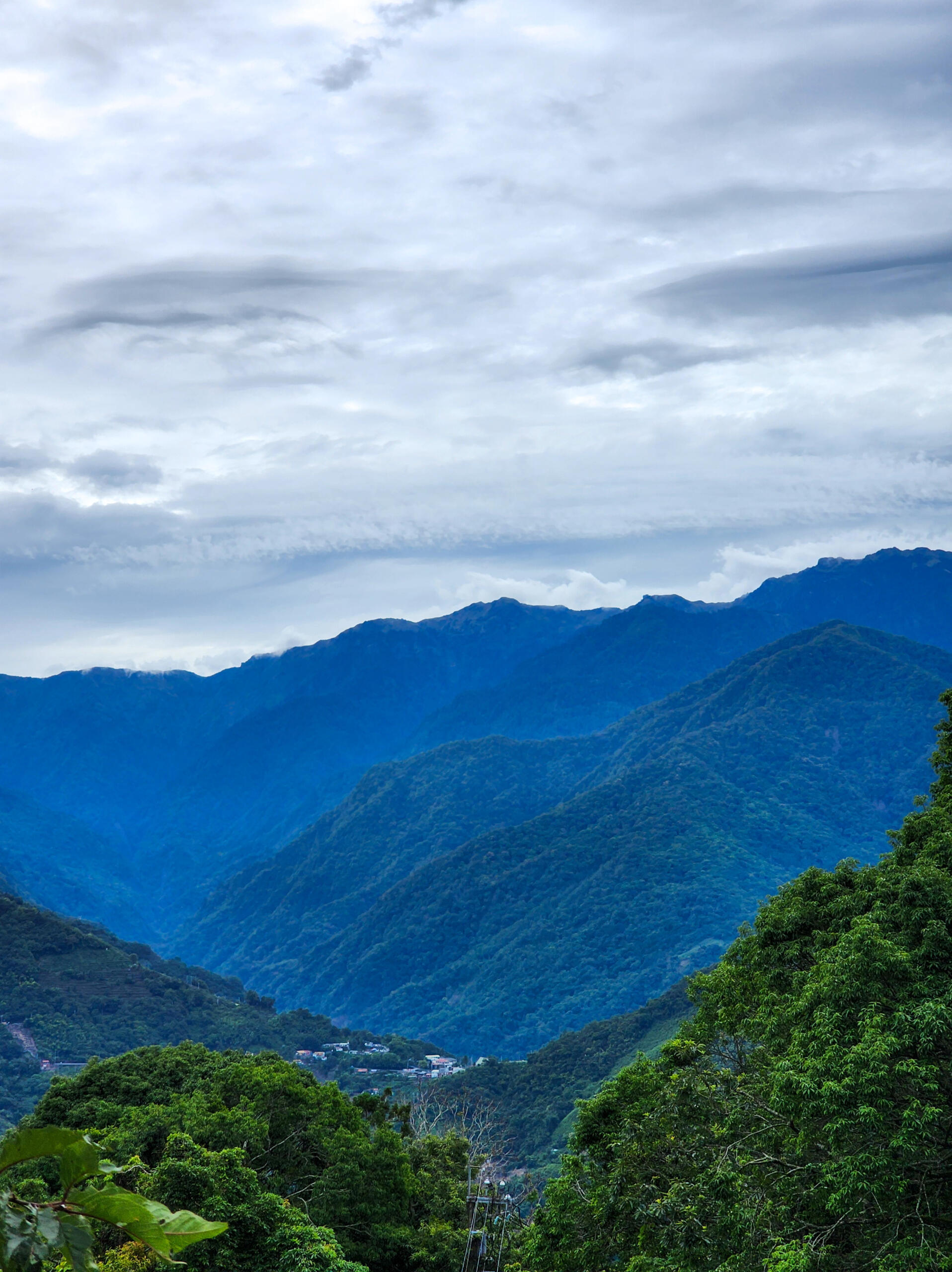
yunnan, kunming - western mountains
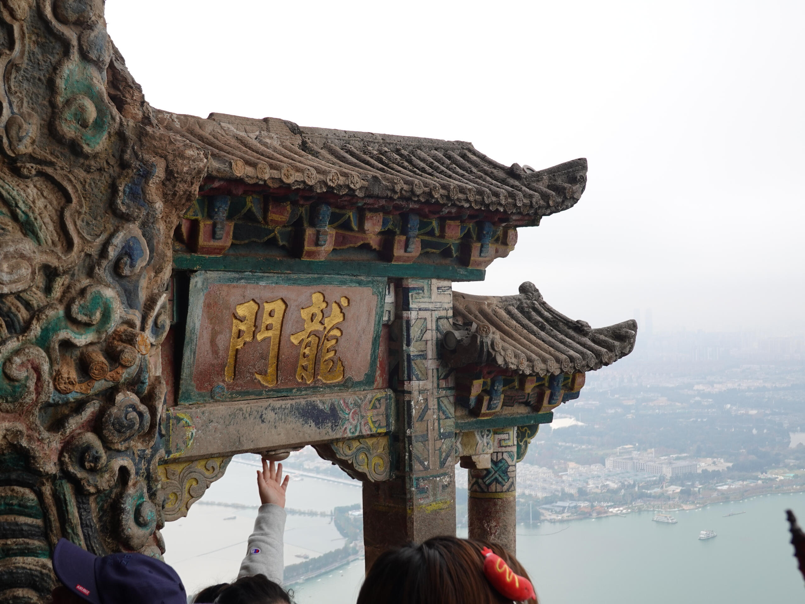
Estimated Duration: 4 hoursDiffculty level: 4/10We made our way to the Western Mountains bright and early in the morning via the train and snacked on food that we purchased from the road-side stalls to the mountain trailhead. We took a bus to the mid-section of the trail, followed by a chairlift to another part of the trek. From there, we climbed towards Lingxu Pavilion with the fog rolling in. When all of us gathered at the pavilion we could barely see the scenery but took pictures anyways. We then made our descend to the legendary Longmen, said to bring good fortune and spiritual enlightenment to those who pass through it. Along the way back to the trailhead, we came across many temples and caves.Footprints: 18 Dec 2024
yunnan, dali - cangshan
Estimated Duration: 3.5 hoursDifficulty Level: 3/10Cangshan is very similar to a trail walk, with no significant strenuous hiking elements identified. Cangshan consisted of two halves. It has a middle section as well as a section towards the summit. Both halves can be accessed by the cable car. We first made our way to the half towards the summit. The summit has a slightly higher altitude of 3996m but that was not the biggest concern to us but rather who was finishing up the strawberries we brought to the trek. We descended from the summit and made our way to the middle section via cable car. From there it was the descent to the Seven Dragon Pool, which consists of 1175 flights of steps. The stairs were never-ending but we were rewarded with a flat path to stroll while yaping.Footprints: 14 Dec 2024

Yunnan, lijiang - tiger leaping gorge
Estimated Duration: 8 hoursDifficulty Level: 6/10We began our trek at the Tiger Leaping Gorge early in the morning, driving up to our accommodation for the night at the Halfway Guesthouse. The Tiger Leaping Gorge tested our endurance with steep trails, misty waterfalls, and unexpected goat encounters. We ended off the first part of our trek at Zhang's Guesthouse before heading down towards the Gorge to see the water close up. We trekked back up as the sun was setting and headed off back to our accommodation for the night.Footprints: 12 Dec 2024
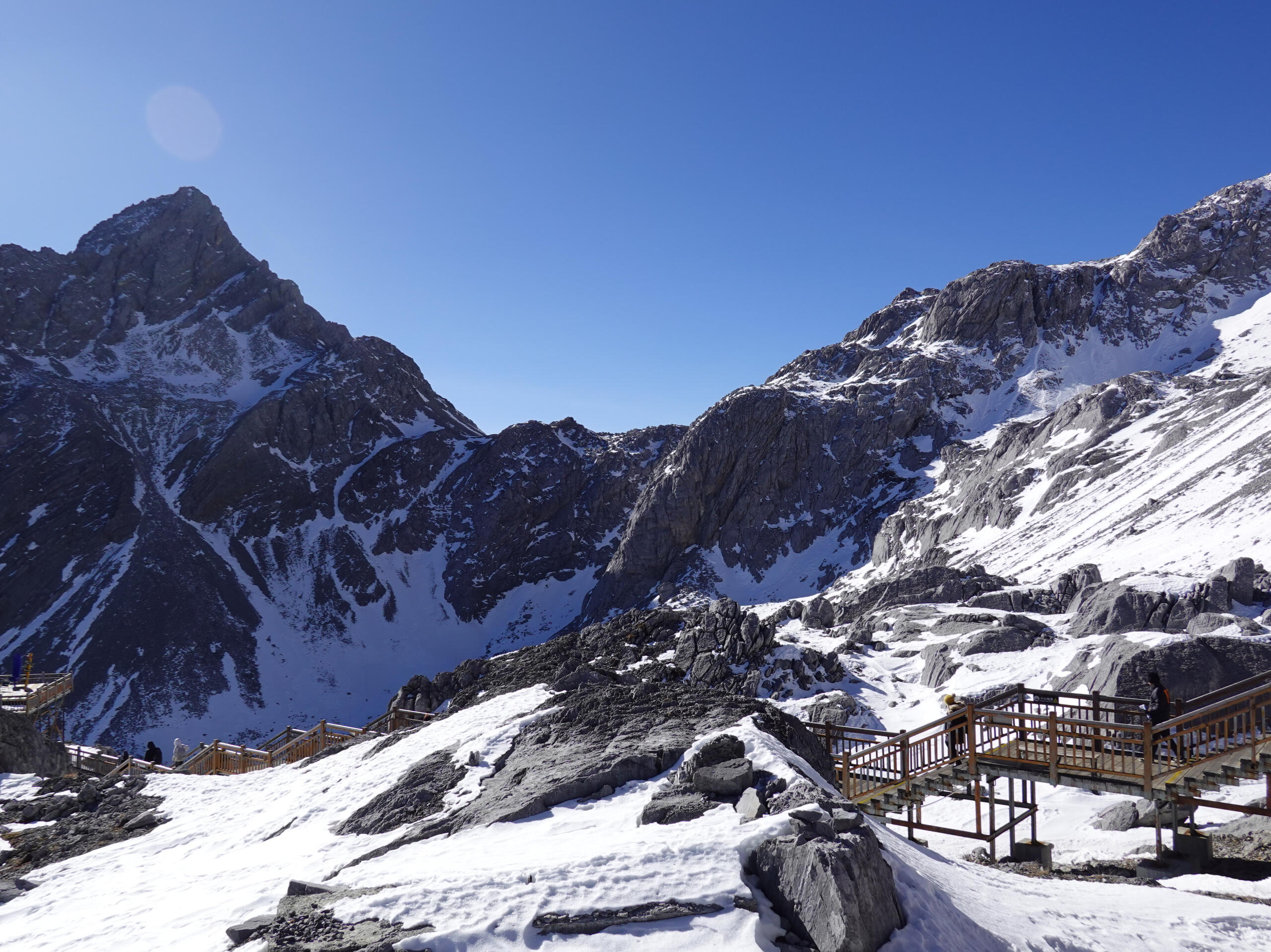
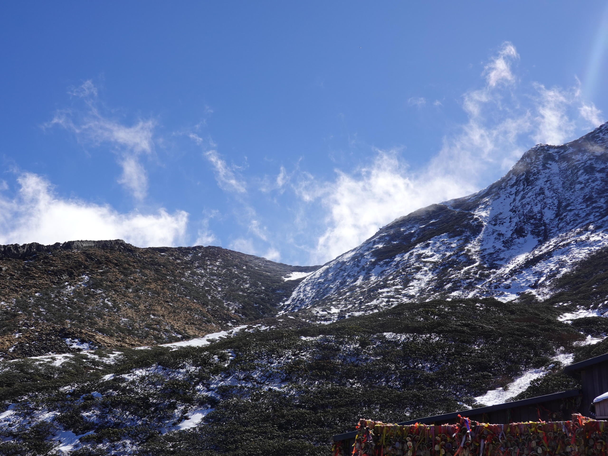
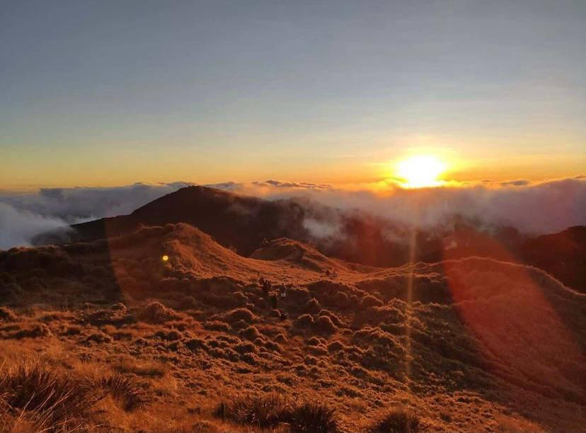
Yunnan, Lijiang - Jade Dragon Snow Mountain
Estimated Duration: 4 hoursDifficulty Level: 7/10Although classified as a recreational activity, our climb up the stairs of the Jade Dragon Snow mountain took us out physically. This trek has a particularly high grading despite it being a simple trek with a cable car up to the starting point. The reason for the grading assigned was, mainly due to the attraction being at high altitudes, with the summit being 4680m. We were equipped with oxygen cans and altitude sickness pills but were breathless quickly after we began ascending the stairs. We took breaks as needed and sucked our oxygen cans dry by the end of the trek.Footprints: 11 Dec 2024
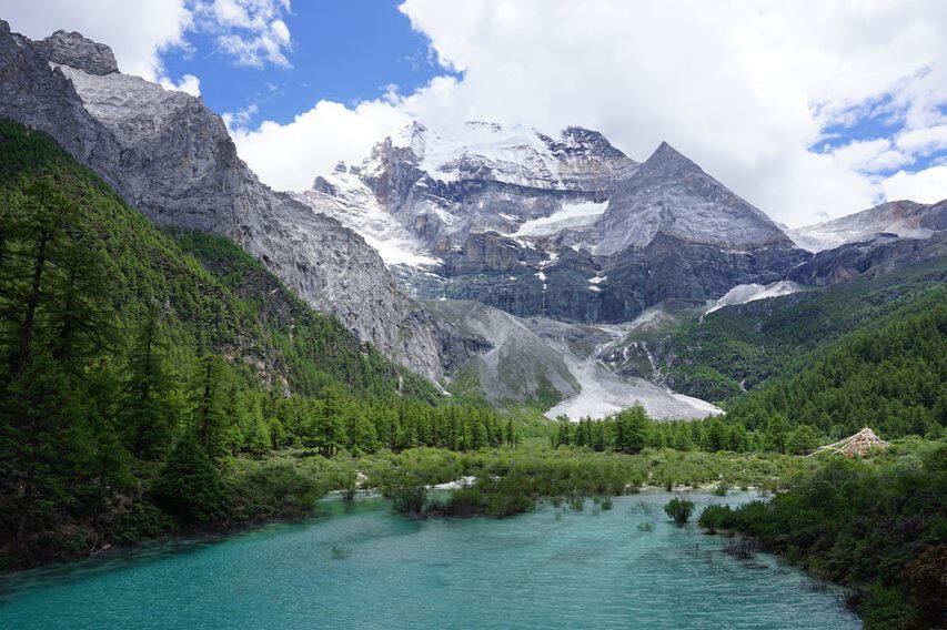
SICHUAN-YADING NATURE RESERVE
Estimated Duration: 3D2NDifficulty Level: 2.5 out of 5 starsThe nature reserve contains various trails that cannot be fully explored within a day. Day treks are recommended, as well as a few days of rest prior to the climb to acclimatize. Despite clear paths available to guide us around the mountains, the altitude of 370om and beyond adds to the difficulty of trekking around the nature reserve. However, the views and the experience are certainly well worth the climb, and the hardest part of the trek was leaving.Footprints: 18-29 Jun 2018
GUANGZHOU - Baiyun Shan White Cloud Hills
Estimated duration: 1-2 HoursDifficulty level: 0.5 out of 5 starsTired of the harsh walls of the city? Bai Yun Shan is a small hill-cum-park with views of the entire Guangzhou from its viewing point (382m). It is a fairly popular place for locals and tourists alike and is nice for a relaxing walk to unwind while enjoying the scenery. For the thrill seekers, there are side activities like carnival rides and bungee jumping!Footprints: 24th Dec 2016
GUILIN - Diecai Shan Folded Brocade Hills
Estimated duration: 2 HoursDifficulty level: 1 out of 5 starsA park located in the heart of Guilin. From the top (~100m), you can enjoy panoramic views of Guilin and how the city and its surrounding limestone karsts flows around each other to form a single entity. It has several peaks which has its own unique offerings and views. An easy enough climb and don't forget to take the good luck slide down from one of the peaks on the way down!
Footprints: 21st Dec 2016
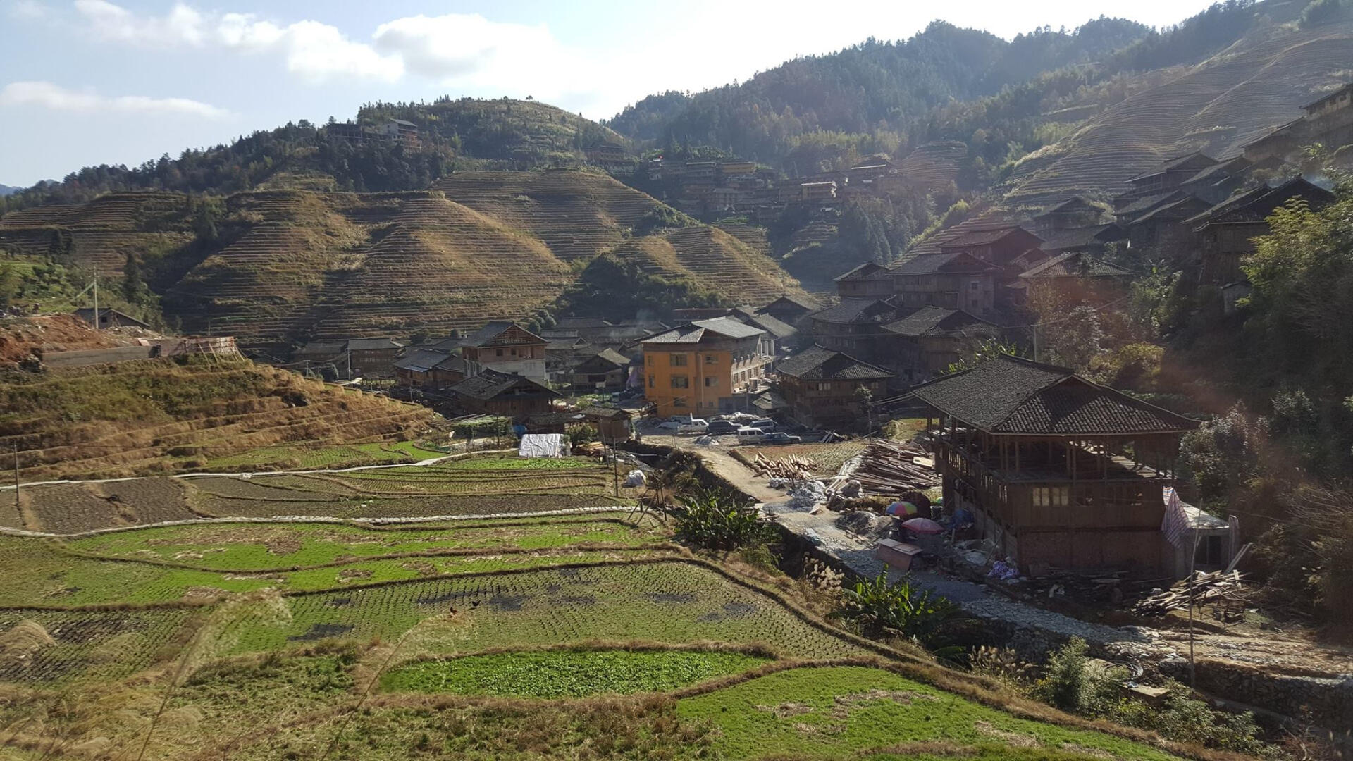
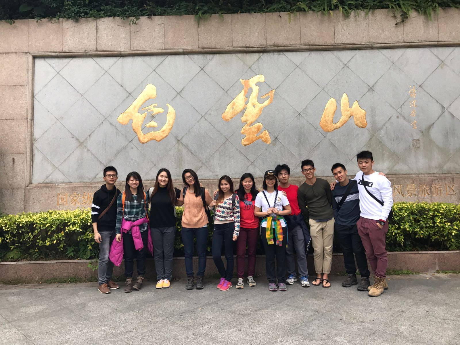
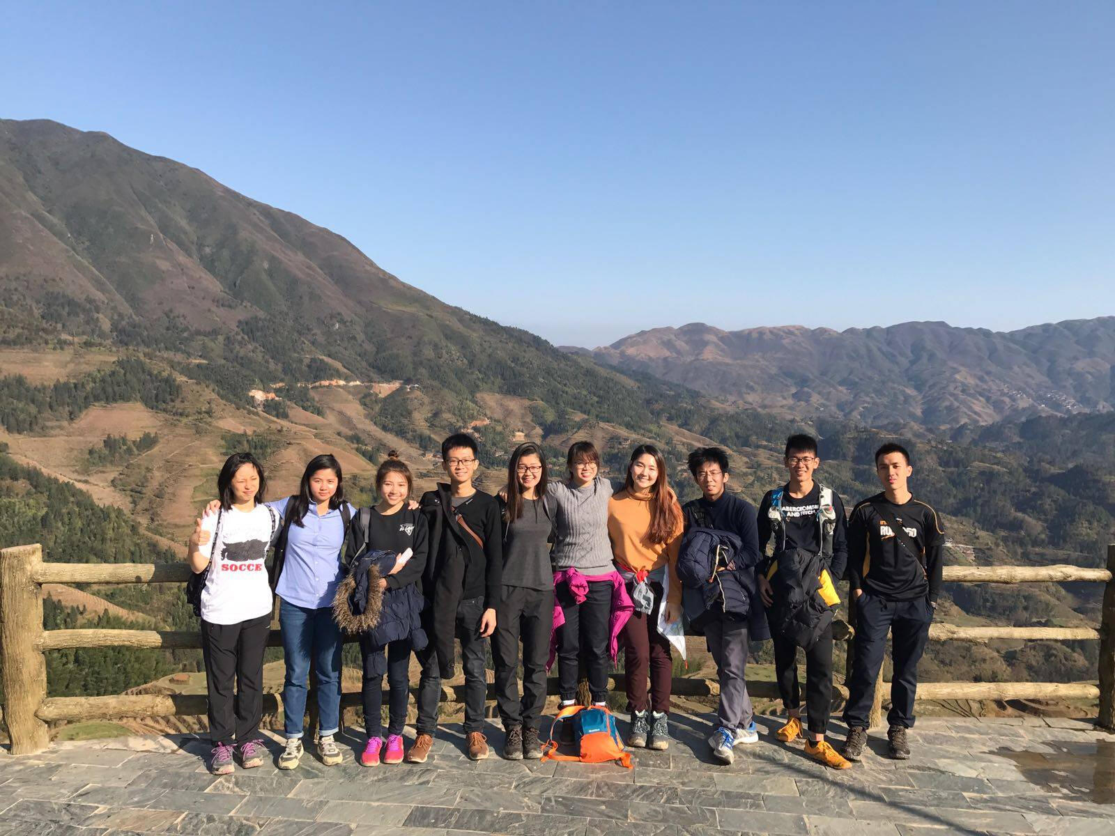
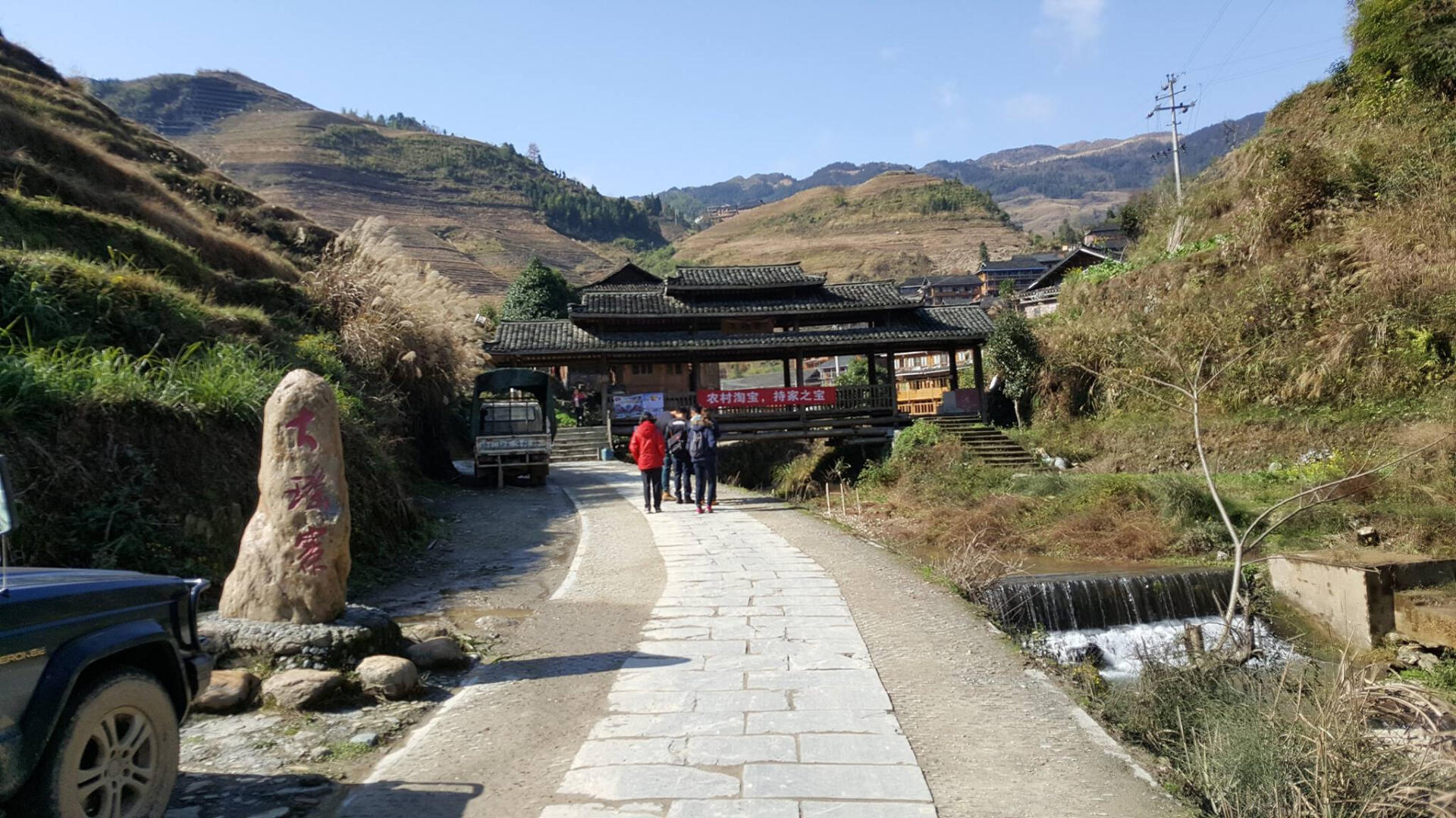
GUILIN - Long Ji Rice Terraces
Estimated duration: Half dayDifficulty level: 1 out of 5 starsLocated in the outskirts of the Guilin are the Longji Rice Terraces. The entire group of rice terraces consists of the Longji Rice Terraces, Ping'an Terraced Fields and the Jinkeng Red Yao Terraced Fields. For the singular Longji Rice Terrace, do set aside at least half a day to soak up the calm atmosphere and bask in the peaceful vibes of the rice fields. If you get the chance, stop by for lunch in one of the villages run by the Yao Women and you might even get to see them let down their famously long hair,Footprints: 23rd Dec 2016
GUILIN - Yao Shan
Estimated duration: 2 HoursDifficulty level: 2 out of 5 starsThere's a museum, nice garden with statues and food stalls at the top, and there are two known ways for you to get there! First option would be the chairlifts up the mountain which most tourists use, but it only takes you up to a maximum of 600 to 700m. Don't be fooled by the chairlift ticketing booth officers who will tell you to buy a chairlift ticket at the bottom, as this is definitely not the only way up Yao Shan! The hiking path is just behind some alley on the left end of the carpark, we'd suggest you ask the locals for clearer directions on the ground. You can expect a simple dirt trail terrain with some steep sections where you'll need to use your hands. On the way halfway point back down, try taking the toboggan slide to the bottom of the mountain.
Definitely an interesting and must-try experience sliding down a mountain!Footprints: 22nd Dec 2016
YANGSHUO - Xiang Gong Shan
Estimated duration: 1-2 HoursDifficulty level: 1 out of 5 starsAn easy enough hike up stairs which curves around the mountain. It peaks out at about 300m and presents you with unblocked views of Yangshuo and the meandering of the Li River. Many people have been known to come and catch the
sunrise. However, the weather can be foggy causing low visibility like when we went in the morning, so you'll need a bit of luck to catch all Xiang Gong Shan has to offer.Footprints: 20th Dec 2016
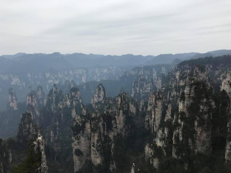
Wulingyuan - Zhangjiajie National Park
Estimated duration: 3 days or moreDifficulty level: 1 out of 5 starsZhangjiajie National Park is home to the Hallelujah Mountains from the movie Avatar. Being an AAAAA scenic area rated by the China National Tourism Administration and a UNESCO World Heritage Site, you will definitely be awe-inspired by its quartz-sandstone pillars and its karst landscape. It is also the first national forest park in China as well. You can visit Yuanjiajie - the inspiration of the Hallelujah Mountains in Avatar, Golden Whip Stream, Yellow Stone Village Mountain and the more recently opened Yangjiajie area. Navigation area is relatively easy because the paths have proper signages. Of course, you can always choose the easier way up using the cable cars, internal shuttle buses and the Bailong lift but what is an adventure without doing the treks yourself? Apart from the Zhangjiajie National Park, you should also head over to Tianmen Mountain! Not only home to the world's longest cable car ride, it is also home to the Cliff-Hanging walkway, 999 steps Stairway to Heaven which leads you to the Heaven's Gate well as the 99 Bends which takes you up the mountain should you not want to take the cable car.Footprints: Dec 2017
INDIA
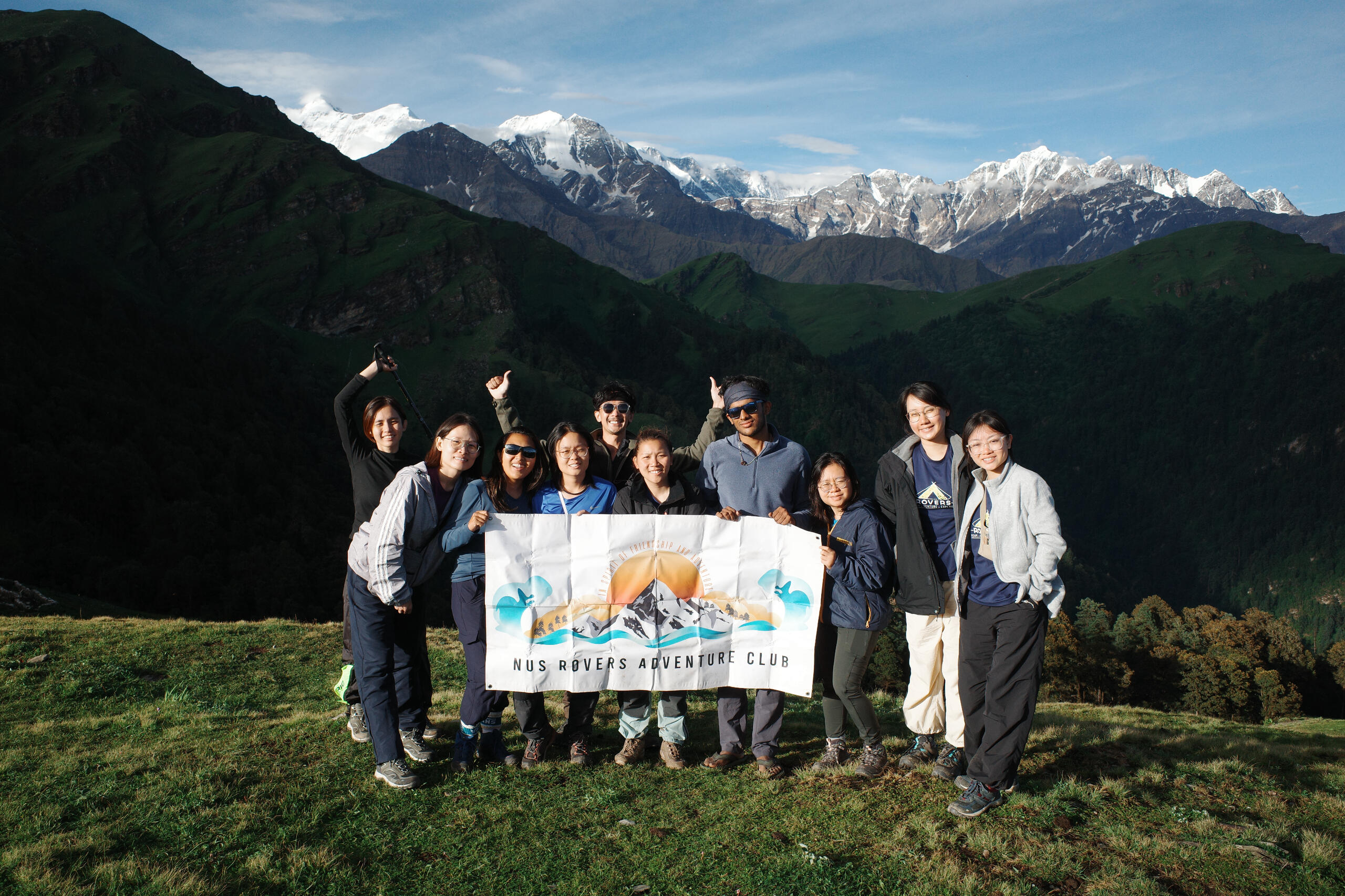
Ali bedni bugyal
Estimated duration: 4D3NDifficulty level: 4 out of 5 starsOur trek began with a climb from Wan through dense oak and rhododendron forests, leading us to Ghairoli Patal (3200m), where we camped and were treated to an unforgettable alpine glow as the sun set, casting warm hues over the peaks. The following day, we trekked up to Bedni Bugyal (3350m), though heavy monsoon fog obscured much of the view, lending a mysterious air to the vast meadow. After camping at Abin Kharak, where we caught fleeting glimpses of the Himalayan peaks, we continued on the third day to the lush, endless meadows of Ali Bugyal, a highlight of the trek with its sprawling green expanse. Later, we descended to Didna (2550m), a remote village nestled in rugged terrain. On the final day, we made our way back to Lohajung, passing through forests and remote villages, bringing the trek to a serene close.Footprints: 26-29 June 2024
CHANDRASHILA
Estimated duration: 3D2NDifficulty level: 4 out of 5 starsTerrain: Easy dirt trails but high altitude (3000m)Chandrashila literally means moon rock in Hindi. It is the summit of Tungnath, home to the highest Shiva Temple in the world, with an altitude of about 400om above sea level. Chandrashila is located near the borders of India, China and Nepal.
The trek starts at Sari Base Camp where the trek to the Deria Tan Lake takes 2 hours. Upon reaching the campsite, we were greeted by the ice mountains and the beautiful lake. The ability to witness the beautiful stars and milky waves certainly made the trip worthwhile. We headed off to Chopta the next day, had lunch at a meadow but unfortunately we got lost. After trekking for 14 hours, 35 km, we finally returned to Sari base camp at 2 am. We slept in and recuperated the next day, hoping to summit Chandrashila peak the following day. Perhaps we were not meant to be, the snowstorm made the journey to the summit dangerous.Footprints: 7-18 Dec 2017
JAMMUN AND KASHMIR - LADAKH: ZINGCHUAN TO CHILLING TREK
Estimated duration: 3D2NDifficulty level: 4 out of 5 starsTrek: Total: 33km, 1600m elevation gain, 1800m elevation lossTerrain: Easy dirt trails but high altitudeDown a winding road from Leh town, disembark from your scenic ride at Zingchen, and be immediately confronted by the background towering reddish-brown peaks of the Ladakhi range taking the front stage. What looked like a painting from the comfort of your seats, is catapulted into vivid splashes of all colours that besmirch your mortal senses. Along a trek of diverse gradients and dynamic scenery, expect to turn around to the sound of "Ju-Leh" by friendly herdsmen and passing ponies. You'll spend the first night in Yurutse (4100m), a cozy village with a grand total of one house before departing again early next morning for the long ascent toward Ganda La Pass. At (4980m), the highest point of the trek. Past Ganda La is a beautiful descent into the valley, accompanied by eagles and marmots. Take a rest in the second homestay by hitting the green plains of Shingo village (4100m). The track from Shingo to Skiu for the last day intersects the river many times like two mating dragonflies in a downward spiral. You'll find yourself walking along eternal glacial streams and also across rivers of the valley. Charge through Skiu (3360m) and you're on your way to Chilling. Witness dramatic landscape changes as the valley opens up into the wide Zanskar River. The trek ends with a manual cable car ride across this vast and fast-flowing river! Your vehicle will pick you up and head back to Leh through winding roads and immense rock cliffs.Footprints: 4-6 July 2017
INDONESIA
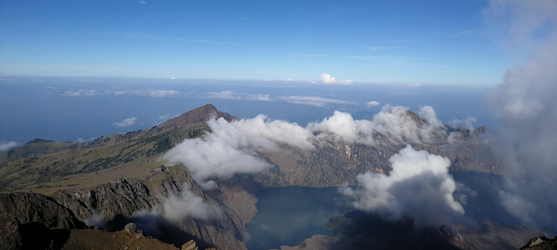
MT RINJANI
Estimated duration: 3D2N or 4D3NDifficulty level: 4 out of 5 starsMt. Rinjani is no mean feat! With every step you take, be prepared to sink into the fine volcanic rocks and slide back a little... not really a little to be fair. Still, with perseverance, this peak is definitely possible. Get rewarded with the best crater lake view, ethereal sunrise above the clouds at the summit and take photographs with the 3726m plaques! Remember, photograph the moment or it didn't happen! Thereafter, descend into the crater lake and soak yourself in the revitalizing hot springs. Camping in the crater lake is a good option if you do not want to climb back up to the crater rim again on the same day. For the last day, enjoy your time descending slowly away from the rocky terrain into a tropical one. Go easy on your knees! If you are looking at trail running, it's also a pretty fun experience to run down (but be careful!). There are several options to do this trek. We recommend tackling this active volcano from Sembalun to Senaru as you get to do the summit push on the second day early morning (2am) to catch the sunrise after seeing the beautiful milk way at night. The 3D2N (just nice) or 4D3N options would be just about right for anyone who wants to take on this challenge, but be prepared for a good one!Footprints: 20-22 July 2017, 13-20 May 2018, 5-12 August 2023
MALAYSIA
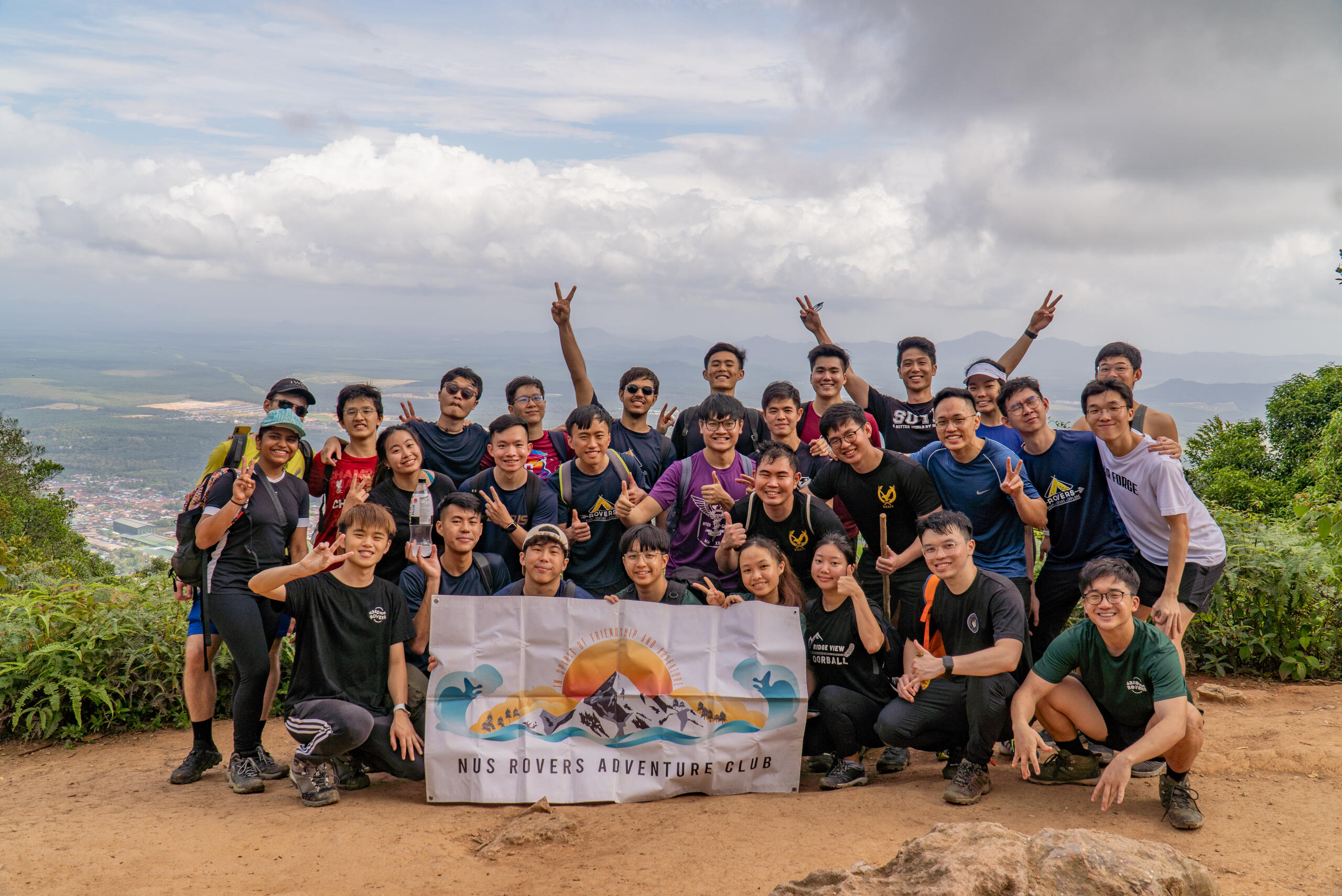
Gunung lambak
Estimated duration: 4-6 hoursDifficulty level: 3 out of 5 starsGunung Lambak, located in Kluang, Johor Bahru provides a reasonably challenging trek for its proximity to Singapore! A popular spot for locals, this mountain offers a mix of paved trails, scrambling among tree roots, and steep trails. This mountain also boasts two peaks that you can hike to! The first is the summit, at its tallest point, where you get an aerial view of the Kluang town. At the second peak, stands an extremely tall tree with a thick trunk. Locals say that the circumference of the trunk is equivalent to seven people's arm-spans! Back in Kluang town, don't miss its famous Kluang Rail Coffee for some delectable kopi and kaya toast!Footprints: 19 Feb 2023, 22 Feb 2023
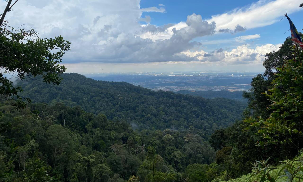
Gunung PULAI
Estimated duration: 4-6 hoursDifficulty level: 2 out of 5 starsGunung Pulai is a 654m tall mountain in Johor Bahru, a popular hiking spot for both Malaysians and Singaporeans. After a steep climb up to the safety debrief point, it started pouring cats and dogs! Nonetheless, it did not dampen our spirits as everyone soldiered on and began trekking carefully in the wet and muddy conditions. The trek consisted of 3 steep ascensions, where we depended on tree trunks and roots to climb. Eventually, we reached the summit after a tiring 4 hours and were greeted with this amazing view. We then descended via the tar road which was less tiring but taxing on our feet. However, Gunung Pulai Waterfall provided us with the refreshment we needed as we dipped our feet into the cooling waters.Footprints: 31st July 2022, 24 Feb 2024

JOHOR (Kota Tinggi) - Gunung Panti
Estimated duration: 6 hoursDifficulty level: 1 out of 5 stars, 3/10Gunung Panti is one of the more popular treks in Malaysia, offering a modest hike of 531m to the summit through jungle terrain. There are two trails available that are basically the reverse of each other. Starting the hike from the trailhead near the main road will bring you to the only toilet on the trail in just a few minutes. While the trail itself doesn't have many signs, looking out for cloths or tape that are tied around trees would guide you in the right direction. A GPS might come in handy too! Although the views at the summit are limited, it still invites you to a gracious view of the vast land of forests across. Gunung Panti also lets you have a taste of descending a near-vertical wall, but not to worry as there are ropes available to help you out. One characteristic trait about this trek is that it is FULL of leeches, yes you have been warned! Do prepare protection measures to reduce your chances of leech bites but don't let the leeches stop you from enjoying this hike!Footprints: 27th Sept 2017, 18 Feb 2023, 21 Feb 2023, 23 Feb 2025
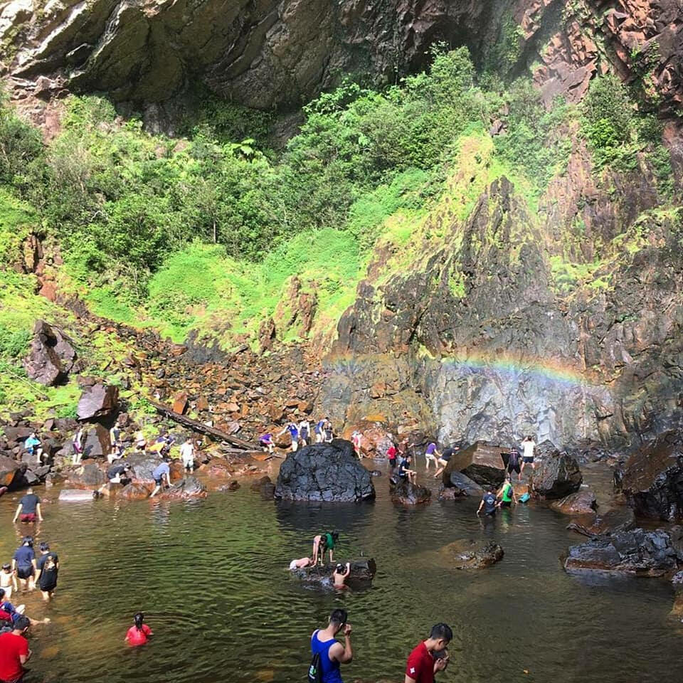
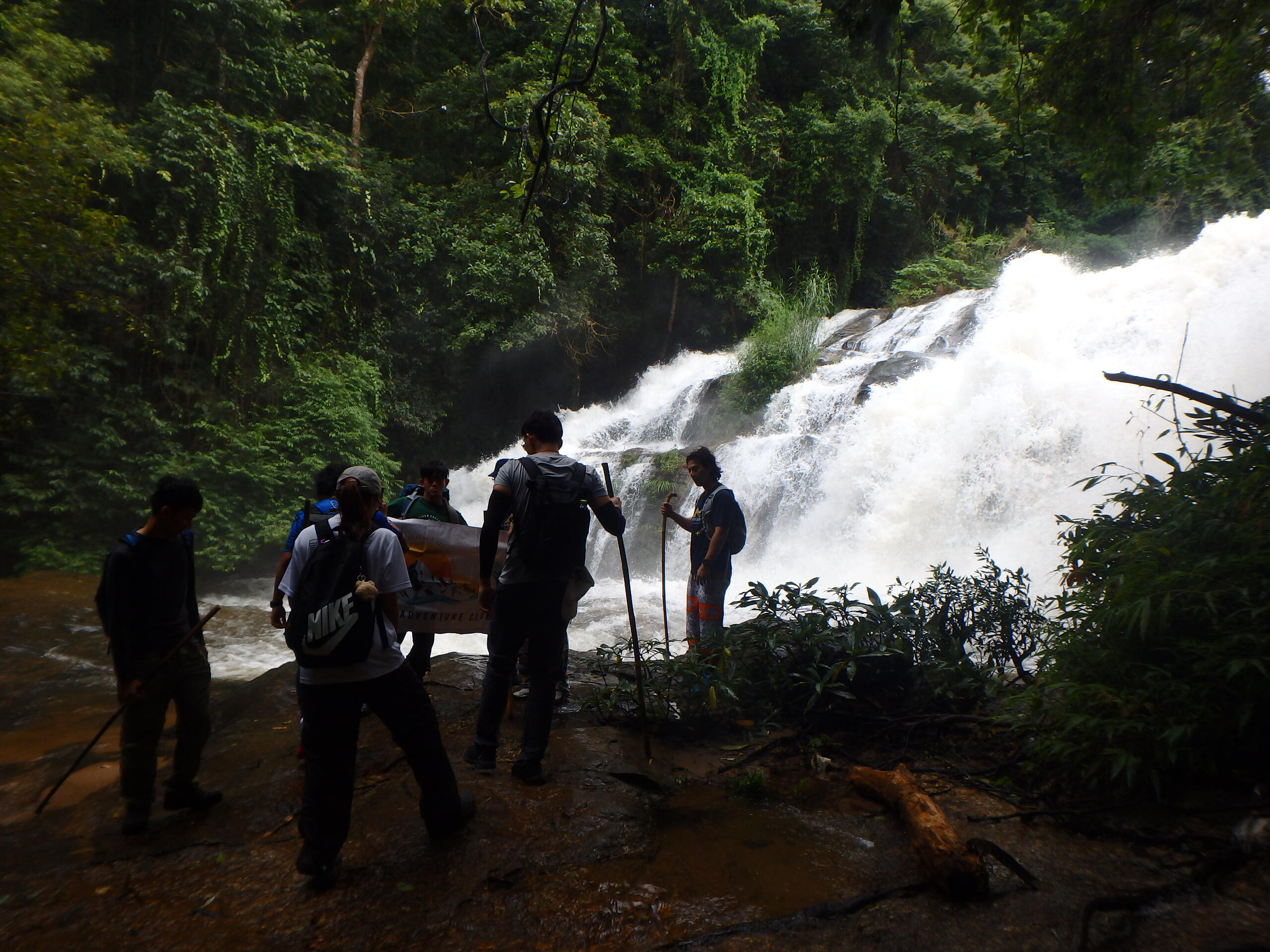
PAHANG - RAINBOW FALLS
Estimated duration: Half-dayDifficulty level: 1 out of 5 starsEasily another one of our favourite treks here at Rainbow Falls! An early morning jeep takes you into the deep jungle towards the trailhead. It comprises a knee-high river crossing followed by a simple 30 min jungle trek. Be careful as the terrain may be wet and slippery. Although grand, the waterfall is more of a shower, and the rainbow WILL appear given enough sunlight between 9-10 am. For a popular destination like this, you can expect large crowds during the weekends but, the more the merrier, right? Sandals/Water shoes will be sufficient for this trek and the guides usually provide free milo and cup noodles, perfect for a light snack by the waterfall! Rainbow Falls provides a great ambiance and a pleasant escapade with friends. Get wet!Footprints: 29th July 2017 & Feb 2018
JOHOR (Ledang) - Mt. Ophir
Estimated duration: 1DDifficulty level: 3.5 out of 5 starsAfter many years, we brought our short overseas trek back to our neighbor country, Malaysia. Boasting a height of 1276m, Mt Ophir (also known as Gunung Ledang) puts itself out as the highest mountain in Johor and one of the tougher mountains in Malaysia. Mt Ophir can be completed within a day, a good recommendation for a weekend hike for many trekking enthusiasts. However, this suggestion can be reasonably challenging due to its many high steps and steep slopes which have to be overcome with ropes and ladders, coupled with the time limit to return to base before it gets dark. Another viable and simpler option would be tackling this mountain in a 2D1N trip, which sets a comfortable pace perfect for anyone looking for a good workout! This quick getaway fauna-filled trek will be sure to ease your tension from the hustle and bustle life of the city.Footprints: 17th Jun 2017, 31st July 2022
JOHOR (Mersing) - Gunung Arong
Estimated duration: Half DayDifficulty level: 0.5 out of 5 starsLocated in Mersing, at only 275m high in elevation, Gunung Arong is one of the shortest and most relaxed hikes that takes you to a beautiful view. Begin the trek into the forest terrain under the canopy and emerge from it at the top to immerse in the spectacular view of the surrounding islands of Mersing! Descend on the other side and the fine sandy beach warmly welcomes you back down. Lastly, enjoy a short sunset stroll down the beach and climb over boulders as you make your way back to the main road via the shore.Footprints: 20th Sept 2016, 30th July 2022
MONGOLIA
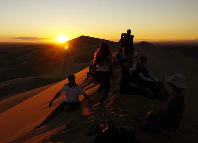
GOBI DESERT - TERELJ NATIONAL PARK
Estimated duration: As short as 4 days, up to 8 days and beyondDifficulty level: 1.5 out of 5 starsNUS ROVERS did our first 7-day desert trek across the vast Gobi, covering popular Gobi sites such as Tsagaan Survafa - an ancient seabed, the Yol Valley, the Khongor Sand Dunes, and the Bayanzag Flaming Cliffs where the first dinosaur eggs were found. The treks were not difficult because they range from a simple 4KM to 16KM. Unfortunately, our trek was cut short to an 8KM one because our vehicle kept breaking down! It was certainly exciting to be able to trek across the vast landscape of the desert land (and sometimes in the dark) which made this experience a truly different one. We also visited the vast grasslands of Terelj National Park, the 3rd largest protected area in Mongolia because what is a trip to Mongolia without the Terelj National Park?The long drives, beautiful desert landscape and the ger experience is something we all won't forget!Footprints: July 2018
NEPAL
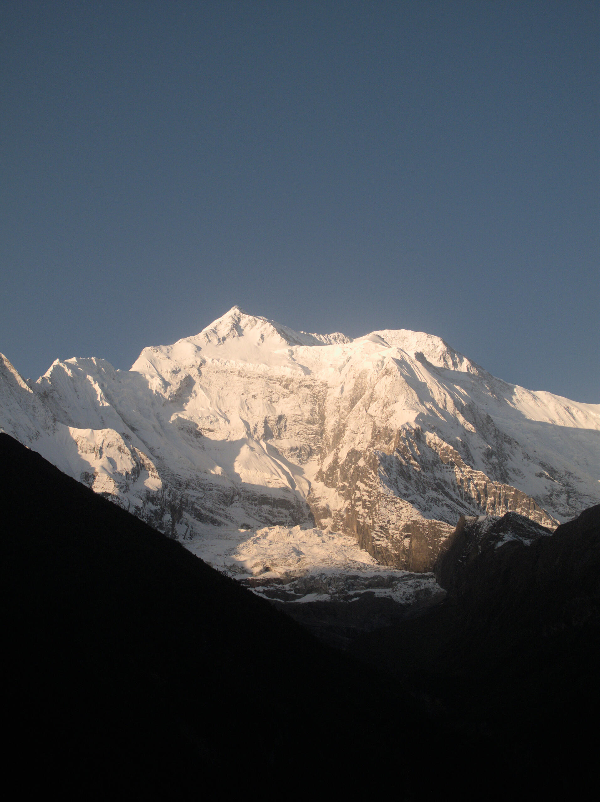
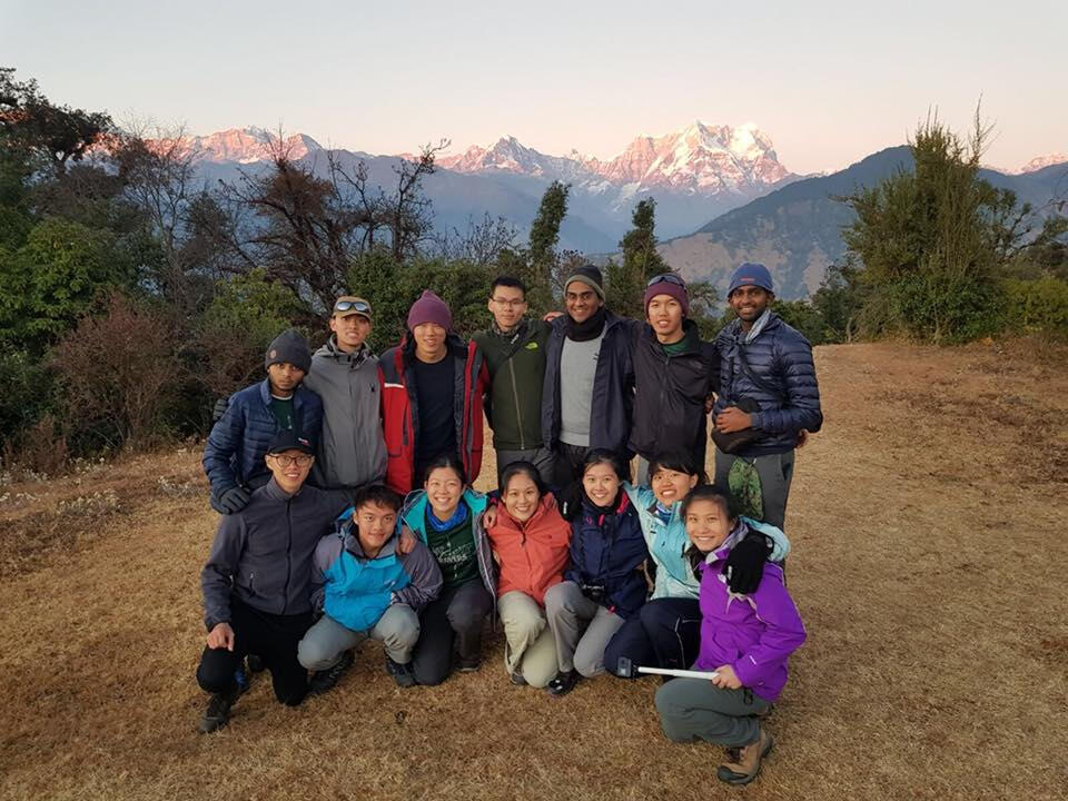
Annapurna Circuit
Estimated duration: 6D5NDifficulty level: 9/10After settling into Thamel and enjoying our first taste of dal bhat, we explored the vibrant streets and prepared for the journey ahead. The next morning, we set off on a scenic drive to Besisahar, where the road narrowed and the mountains began to rise around us.Our trek truly began after a bumpy jeep ride to Chame, with waterfalls, pine forests, and herds of goats marking our first glimpses of Himalayan beauty. From there, we hiked to Upper Pisang, where the scale of the snow-capped peaks began to sink in. We continued to Manang, battling steep inclines and altitude, but were rewarded with stunning views of Annapurna II, III, and Gangapurna. A rest day in Manang turned into a challenging acclimatisation hike to Ice Lake at 4,600m. It was grueling but but truly unforgettable.We pressed on to Ledar and then Thorong Phedi, where we braced ourselves for the climb to Thorong La Pass. On summit day, we started at 3 a.m. in freezing darkness, slowly pushing ourselves to 5,416m. The sunrise lit up the mountains, and the emotional arrival at the pass was a moment none of us will ever forget. The descent into Muktinath tested our tired legs, but also marked the end of our trek.Footprints: 7-12 June 20225
Langtang Valley
Estimated duration: 7D6NDifficulty level: 4.5 out of 5 starsWe landed in Kathmandu on the afternoon of 17th May and after a warm welcome, we enjoyed our first meal in Thamel before preparing for the trek. The next day, we drove along narrow, bumpy roads to Syabrubesi, where we spent the night, eager to start hiking. Our trek began with a steep climb through green valleys and along rivers to Lama Hotel, where we rested after a long day. Over the next two days, we made our way to Langtang Valley and then Kyanjin Gompa, facing rocky ascents, dropping temperatures, and thinning air. On the big day, we hiked to a 4984-meter peak, where fatigue set in but determination got us to the summit despite cloudy views. We celebrated at the top before descending. The last two days were spent trekking back to Syabrubesi, concluding a challenging but breathtaking journey through the Himalayan landscapes.Footprints: 18-24 May 2024
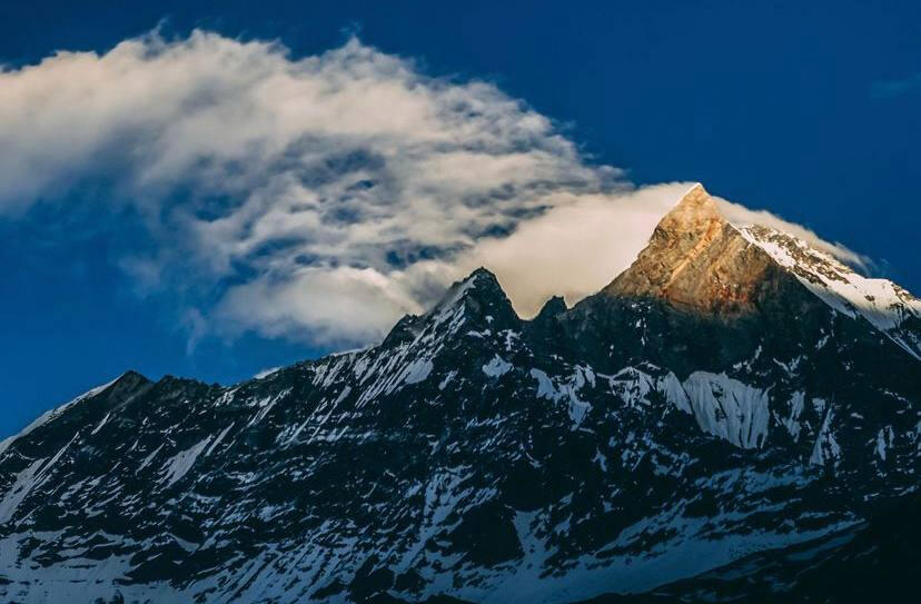
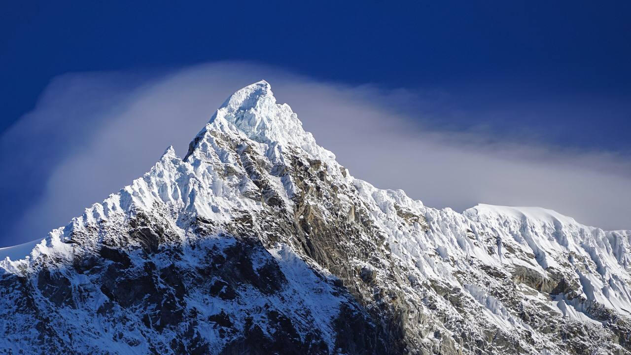
ANNAPURNA BASE CAMP
Estimated Duration: 7D6NDifficulty Level: 4.5 out of 5 starsOne of the most popular treks in Nepal, Annapurna Base Camp Trek offers spectacular views of the diverse landscapes. The trek passes through bamboo and alpine forests, vast valleys and snow-capped mountains to the final destination, Annapurna Base Camp at the height of 4130m. At the Annapurna Base Camp, the breathtaking Annapurna range and Machhapuchhre mountain come into view. Also regarding as a cultural trek, the trek brings you to several villages and you will be staying at the teahouses in some of the villages. The difficulty of this trek comes from having to carry the entire 7-day load as you shift every day. However, having proper beds and a roof over our heads allow you to recharge for the day and take on another few hours of trekking the next day. Annapurna Base Camp trek is suitable for anyone who wishes to challenge themselves and be prepared for an adventure!Footprints: 20th May - 1st June 2018
PHILLIPINES
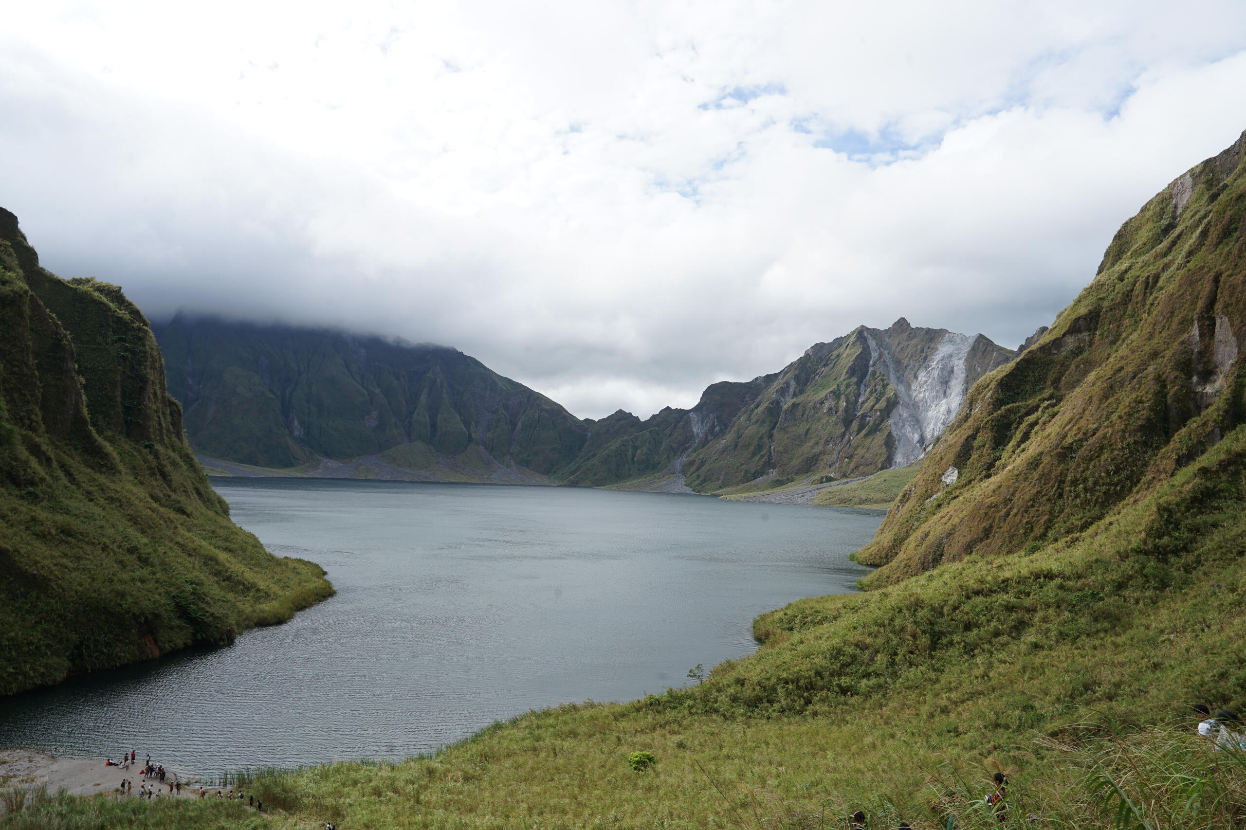
MT Pinatubo
Estimated duration: 1D
Difficulty level: 1 out of 5 starsTrekking to the crater of Mount Pinatubo offers adventurers a captivating journey through breathtaking landscapes. The trek typically begins with a 4x4 ride through lahar-covered terrain. As you venture deeper into the rugged terrain, you will traverse rocky trails and wade across streams, immersing yourself in the stunning beauty of the surrounding wilderness. Upon reaching the crater, you will definitely be rewarded with a surreal sight—an azure lake nestled within the volcano's caldera, a stark contrast to the ash-strewn slopes. The trek to Mount Pinatubo's crater is an unforgettable experience blending adventure, and the beauty of nature.Footprints: 17 Dec 2023
Luzon - MT Pulog
Estimated duration: 1DDifficulty level: 2.5 out of 5 starsIf you are looking for a relatively easy on the legs trek, Mount Pulag is the right choice! Geared with ample outerwear, prepare yourself for a midnight trek to the summit. Admire the night sky painted with thousands of stars and revel in the occasional shooting stars that fly past. Over the span of 5 hours, you will witness dramatic changes in your environment, as you climb through heavy vegetation to reach open greenfields that shyly reveal their beauty as dawn nears. Halfway through the hike, as you emerge from the cloudy fog, expect colder temperatures. Layer on for the final journey ahead. Before you realise it, you would have summited. Bear witness to nature's masterpiece as mountains greet you in every direction that you see. Not long after, the mist will clear and the dark sky will morph into tinges of orange with the view of the breaking dawn. Grab a spot, assemble your camera tripods, and click away at the astonishingly beautiful scenery that came in as a bargain for a relatively easy trek.Footprints: 8-9 Dec 2015, 13 Dec 2016, Dec 2023
SRI LANKA
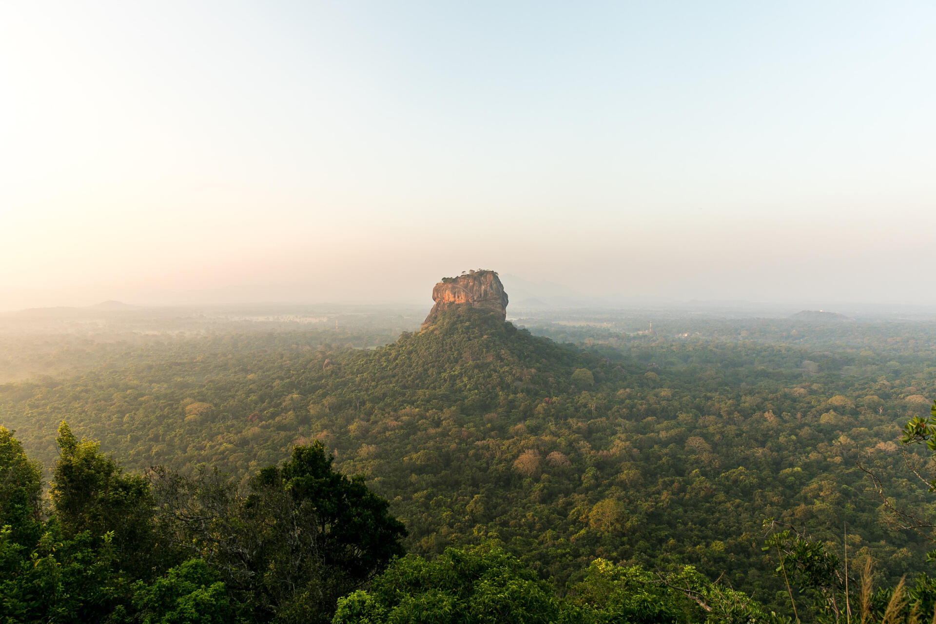
SIGIRIYA- SIGIRIYA ROCK
Estimated duration: 2-3 hoursDifficulty level: 1 out of 5 starsThis is a UNESCO World Heritage site. The routes up to the top of the fortress are well-maintained and takes approximately an hour to reach it. There are many archaeological remains along the way which provides for an enriching experience. This place is a must-see if you are in Sri Lanka as it is a prime example of amazing ancient architecture.Footprints: 4-11 Aug 2018
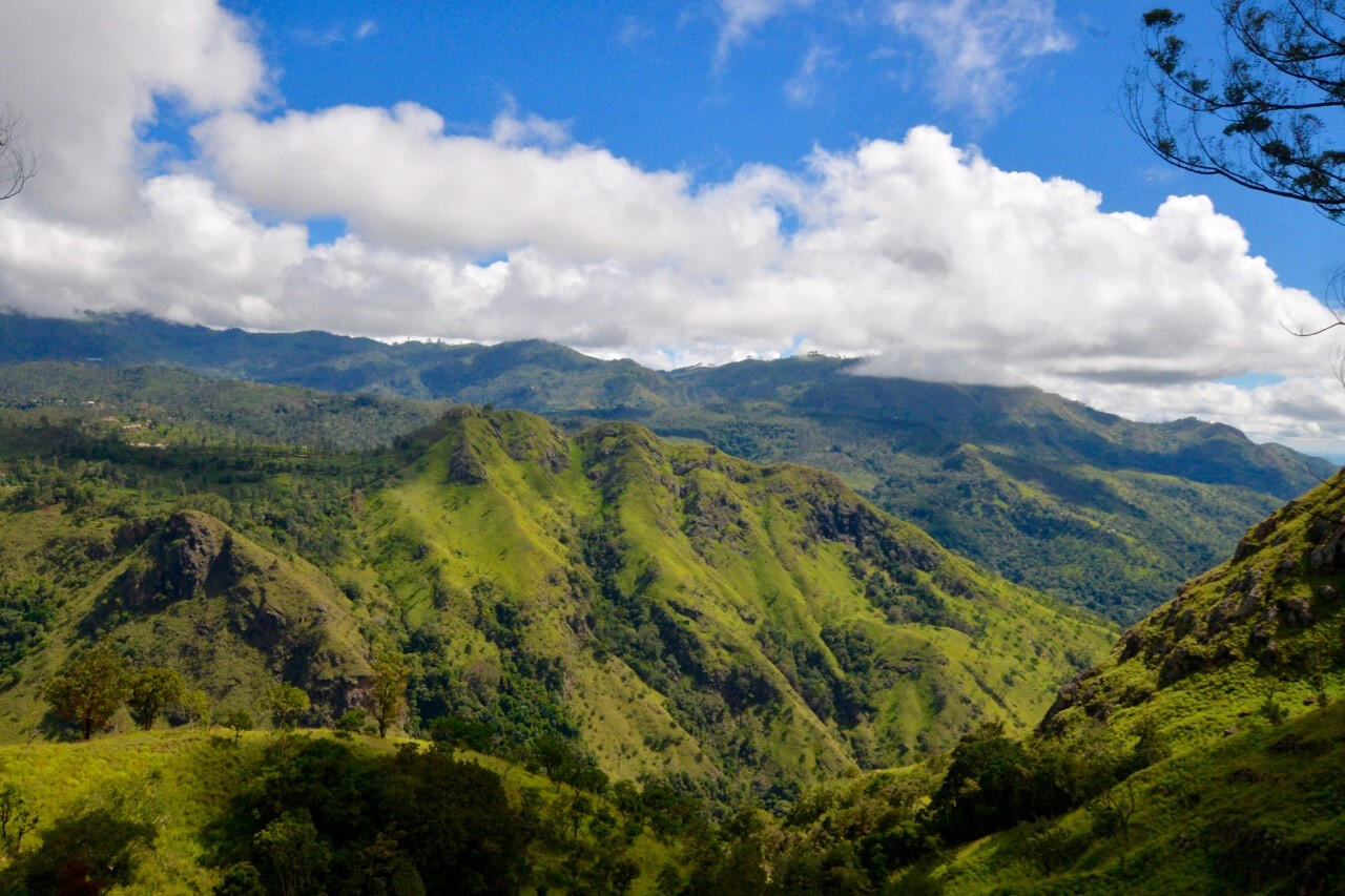
ELLA - ELLA ROCK
Estimated duration: 3-4 hoursDifficulty level: 3 out of 5 starsOne of the highest points in Ella, Ella Rock provides an excellent viewpoint over the region. There is no proper path to the top, but the dirt trails are manageable and easy to climb. The hard part though is locating the trail as it is located a distance away from the railway tracks, and the harder part is following the trail up to the top, as there are twists and turns to be made along the way. It can be tough without doing sufficient research or hiring a local guide. The view on top is, however, definitely worth the hassle that you might go through finding the trail and navigating through it.Footprints: 4-11 Aug 2018
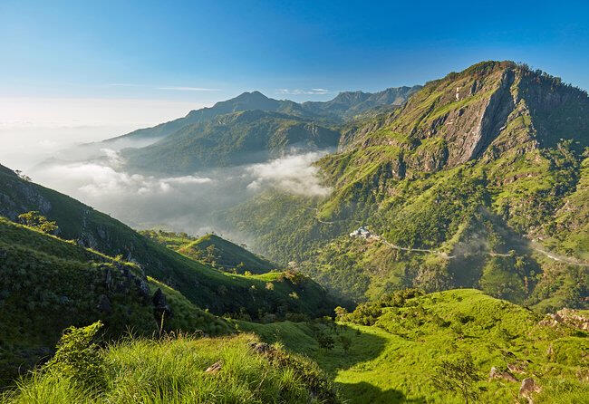
ELLA - LITTLE ADAM'S PEAK
Estimated duration: 1-2 hoursDifficulty level: 1 out of 5 starsThe little brother of Adam's Peak, Little Adam's Peak provides a magnificent vista for the region of Ella for very little effort. The dirt trail and steps are well maintained and the road to the top is not difficult at all, taking us only 45 minutes. Precisely because it is an easy trek, the trail and the peak itself can get crowded with tourists, which is the only downside of the trek.Footprints: 4-11 Aug 2018
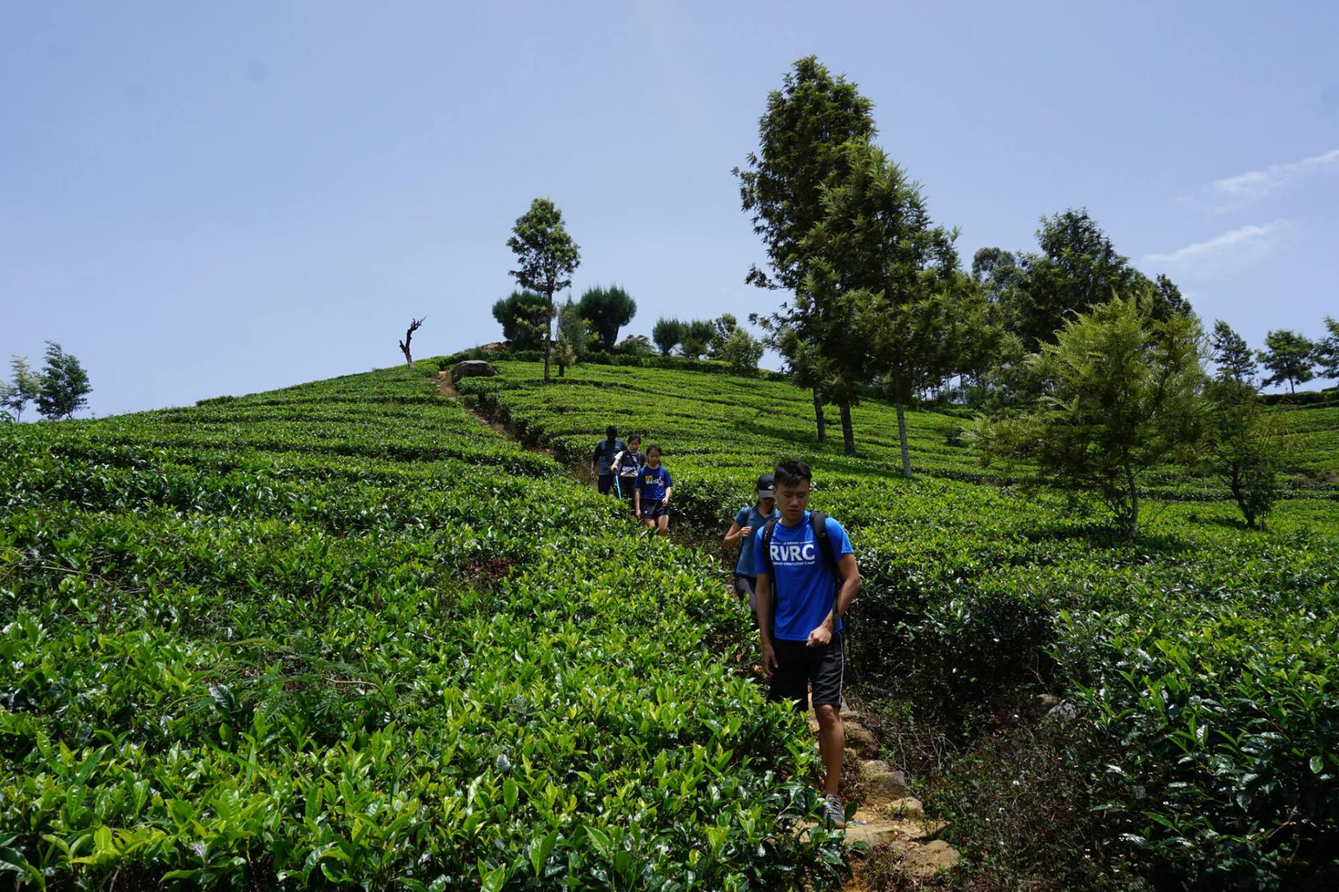
HAPUTALE - Lipton's Seat
Estimated duration: 3-4 hoursDifficulty level: 1.5 out of 5 starsNamed after the Scottish tea baron Sir Thomas Lipton, Lipton's Seat provides an amazing panaromic view over Haputale. The trek up to the peak is beautiful, as you get to walk through countless of tea plantations. At the top, you get to enjoy the view over Haputale, as well as enjoy a cup of tea with some snacks at a small cafe. It can get a little difficult to breathe as Lipton's Seat is located way up in the mountains.Footprints: 4-11 Aug 2018
Pidurangala Rock
Estimated duration: 1-2 hoursDifficulty level: 1 out of 5 starsThe Pidurangala Rock is no less prestigious than its neighbor, the Sigiriya Lion Rock Fortress (UNESCO World Heritage Site). In fact, we would recommend that you check this one out! For one, you'll get to save on the exorbitant tourist price of 30 USD if you were to go to the rock fortress, when you just have to give a token entrance fee of about 5 SGD for the Pidurangla Rock. You'll even get treated to a breath-taking panoramic view that includes the Lion Rock Fortress. It is also relatively much less crowded on the Pidurangla Rock, where you would be sharing the space with just a few other tourists, unlike the rock fortress which sported snaking queues to the peak. Even though this climb is easy, the Pidurangla Rock gives you a chance to get your hands down to literal rock climbing, and rewards you afterwards with cool winds to blow off all the perspiration.Footprints: 28 Jun 2017, 4-11 Aug 2018
THAILAND
Phu soi dao
Trip duration: 2D1NDifficulty level: 6/10In Phu Soi Dao, we braved the cold and exhaustion to witness the final sunset of 2024 and the first sunrise of 2025 at the Thai-Laos border. Camping under the stars, huddling by the fire, and sharing stories made the experience even more special. As we returned to Bangkok, shopping and street food provided a final taste of Thai culture before heading home. A journey of endurance, celebration, and new beginnings—New Year Phu Heights was a trip to remember!Footprints: 31 Dec 2024 – 1 Jan 2025
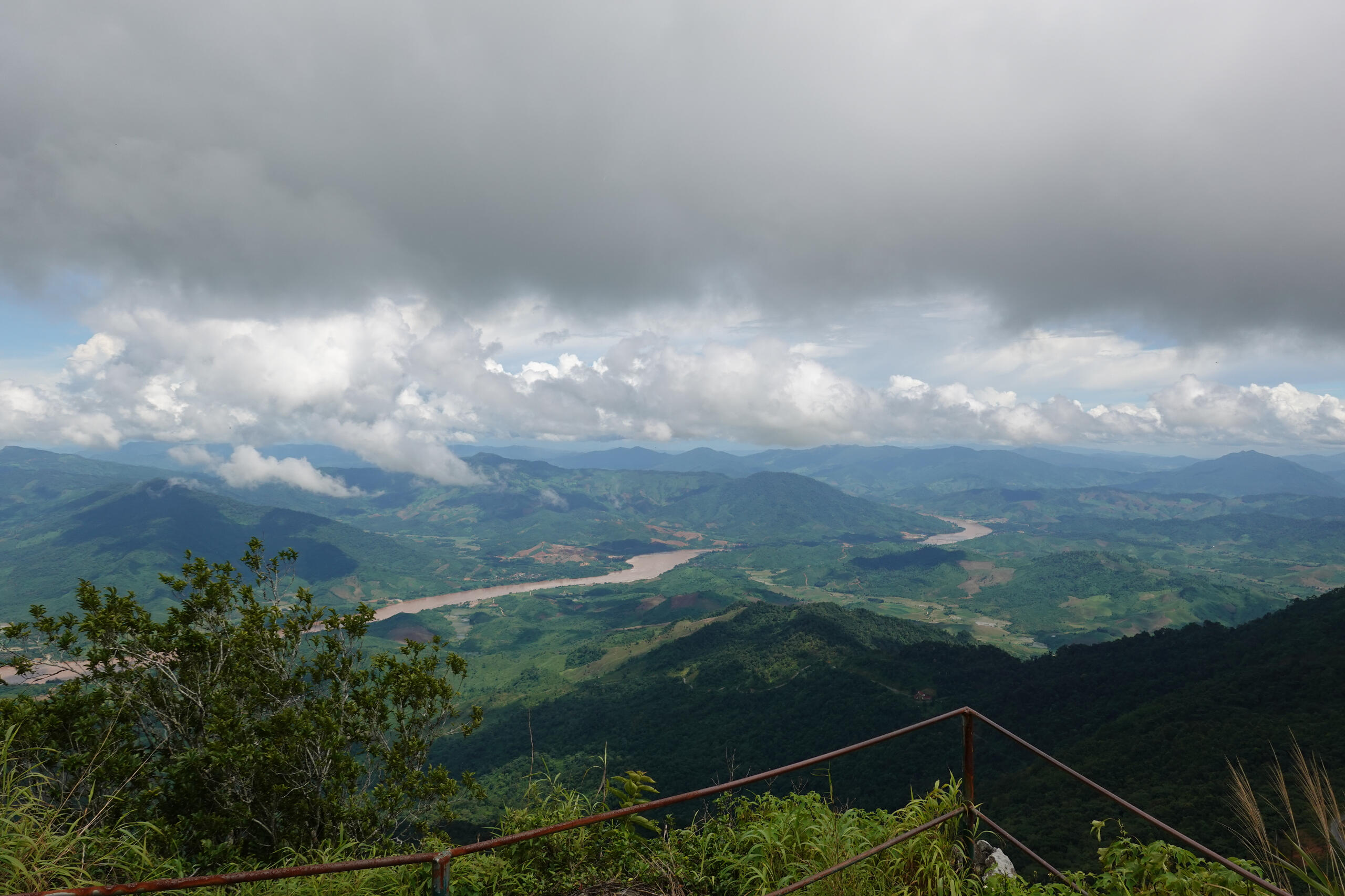
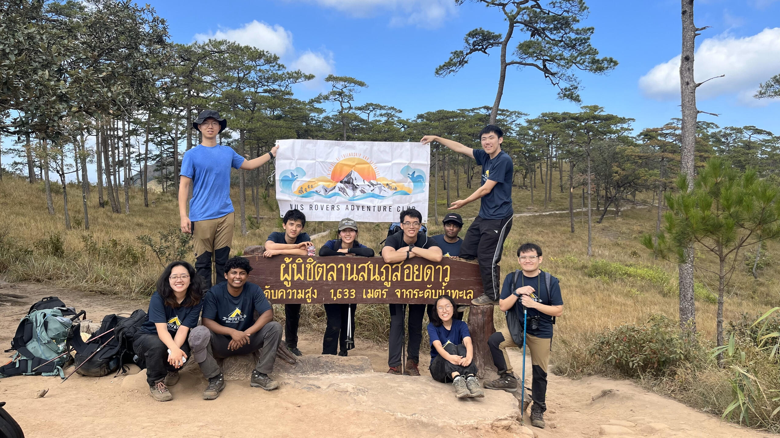
PHU chi fah
Estimated duration: 1DDifficulty level: 2.5 out of 5 starsWe started our day early at 2:30 AM, ready to explore two breathtaking peaks. The initial ascent made our way toward Phu Chi Fah (1,628m), which saw us playing a funny game of "avoid the cow dung" along the way. As we climbed higher, the path became increasingly slippery, leading to several slips and laughs. Upon reaching the summit, a thick blanket of clouds from the rainy season obscured the view, but the misty atmosphere and group photos kept the energy high. After spending some time at the top, we set off for our next adventure: Phu Chi Dao. An hour-long hike led us to a beautiful ridgeline trail, culminating at a higher summit (1,800m). Though the fog still lingered, the dramatic landscape left us in awe. We soaked in the surroundings before descending after a fulfilling day of adventure.Footprints: 7 August 2024
Pha chor
Estimated duration: 1DDifficulty level: 2 out of 5 starsWe set off to explore the natural beauty of Northern Thailand, starting with Pha Chor canyon. The hour-long hike led us through narrow passages between towering rock columns and layered cliffs, offering stunning views of the unique formations. Next, we journeyed to Doi Inthanon, Thailand’s highest peak. Hiking through muddy terrain and humid jungles, we reached the majestic Wachiratharan waterfalls, where the refreshing spray provided relief from the heat. As we continued hiking along the mountain ridges, the sea of green below, dotted with colorful flowers, felt like walking through a painting. As we ascended, the temperature dropped, and we were eventually enveloped by thick fog at the peak of Doi Inthanon. The mist quickly turned into rain, and the freezing winds made for a challenging finish to the hike.Footprints: 2 August 2024
CHIANG DAO - Doi Luang Chiang Dao
Estimated duration: 2D1NDifficulty level: 3 out of 5 starsThe trail head of Doi Luang Chiang Dao (DLCD) is not easily accessible without hired private transport (e.g. Jeeps) as it involves a drive through a few villages and up some steep winding roads. It took about 5-6 hours to reach the campsite, which is just about 30 minutes from the summit. The journey to the summit was the most precarious as the terrain was steep and rocky. The summit is nice and open, and weather permitting, should offer unobstructed panoramic views, so feel free to try catching both the sunset and sunrise. Be warned however, that Chiang Dao is predominantly covered by fog and it really depends on your luck! This trek is definitely possible on your own, with a single well-defined path; one way up and down. If it is your first time here, bring a guide who can explain the place well to you and assure you of your safety and comfort!Footprints: 1-2 Jan 2017
CHIANG-MAI
Estimated duration: 2D1NDifficulty level: 2 out of 5 starsThe climate is pleasantly cooling at the end of the year and sunnier around June. Look out for various fauna and flora as well as take a splash at the waterfalls.Treks are relatively simple and short but can be quite difficult given bad weather. Be welcomed with bright smiles from locals as they enthusiastically share their food and shelter with you. This is one of the more culturally enriching treks you could go on!Footprints: 13-14 Jun 2016
VIETNAM
Ta xua
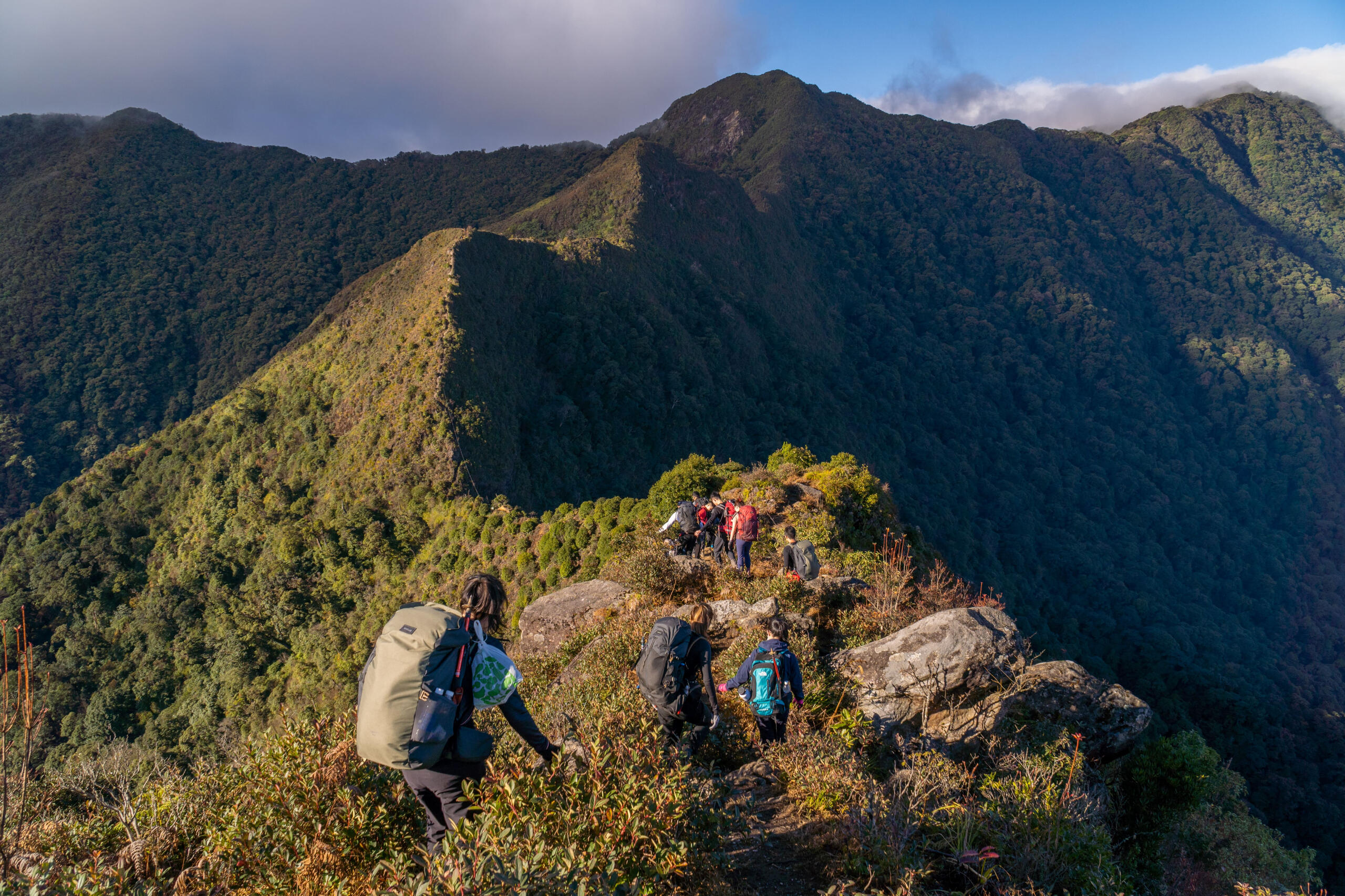
Estimated duration: 3D2N/2D1NDifficulty level: 3.5 out of 5 starsOff the beaten trail, Ta Xua is a lesser well-known tourist destination, but definitely not worth missing out on! This moderate to challenging trek takes you into and above the clouds along muddy paths, jungle trails and rocky ridgelines. Best visited in the winter time (November to February), be prepared to brave the biting cold of the night, where temperatures can drop to as low as zero degrees Celsius! Despite the chill of the night, you will be rewarded with breathtaking sunrises above a sea of clouds!Footprints: 3-5 Jan 2023, 12-13 Dec 2024
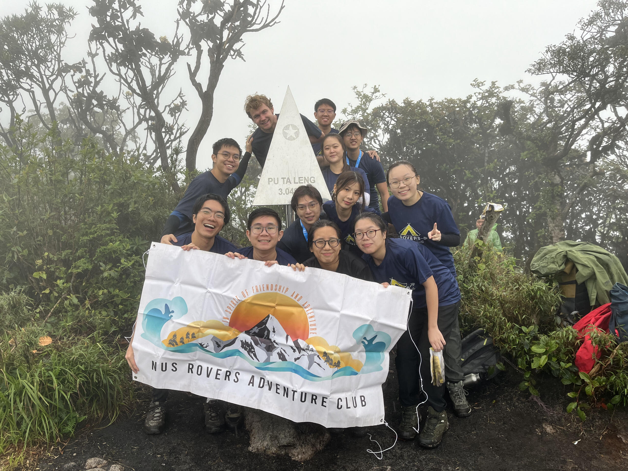
Pu Ta Leng
Estimated duration: 3D2NDifficulty level: 3.5 out of 5 starsWe arrived in Sapa and, after a hearty breakfast at Viettrekking Hotel, set off for the base of Ho Thau trekking point. The hike began with a scenic trail past a small waterfall, where we stopped for lunch. By evening, we reached the Ho Thau Shack, our rest point for the night, and enjoyed a comforting hotpot dinner. On day two, we started early with a misty, cold morning hike toward the summit, passing through bamboo forests and azalea-covered ground. Though heavy rain and mist obscured the peak’s views, the sense of accomplishment kept our spirits high. After a wet, muddy descent filled with river crossings and slips, we arrived at Pu Ta Leng Shack, where we soaked in freezing waters and shared a bonding moment in the darkness. The final day began with beef noodle soup, followed by the continuation of our descent. By early afternoon, we reached the base of the mountains and returned to Ta Leng before heading back to Sapa.Footprints: 12-14 May 2024
LAO CAI - Mt Fansipan
Estimated duration: Half-day or 2D1NDifficulty level: 0.5 out of 5 stars (Cable Car), 3 out of 5 stars (Full Trek)Take it to the sky on the roof of Indochina -Mt Fansipan (3143m). With the construction of the cable car, you can now reach for the sky within 15-20mins! Highly recommended to take the cable car instead of trekking nowadays. What you will get to experience is the one of the most scenic rides above the Muong Hoa Valley with views of paddy fields and into the clouds. The cable car would be a pleasant and more affordable option for the masses, with just some stairs nearing the summit. While saving some time here, you'll have opportunities to explore the vast lands of Sapa, and perhaps some homestay experience too! If you're looking for a decent challenge then the 2D1N trekking is the right choice for you. Be prepared for a steep ascent that will let you reach the summit of Mt Fansipan before sunrise and before the bulk of tourists swarm the monumental peak!Footprints: 6th Dec 2016, 9th to 10th Jan 2024
LAO CAI - SAPA
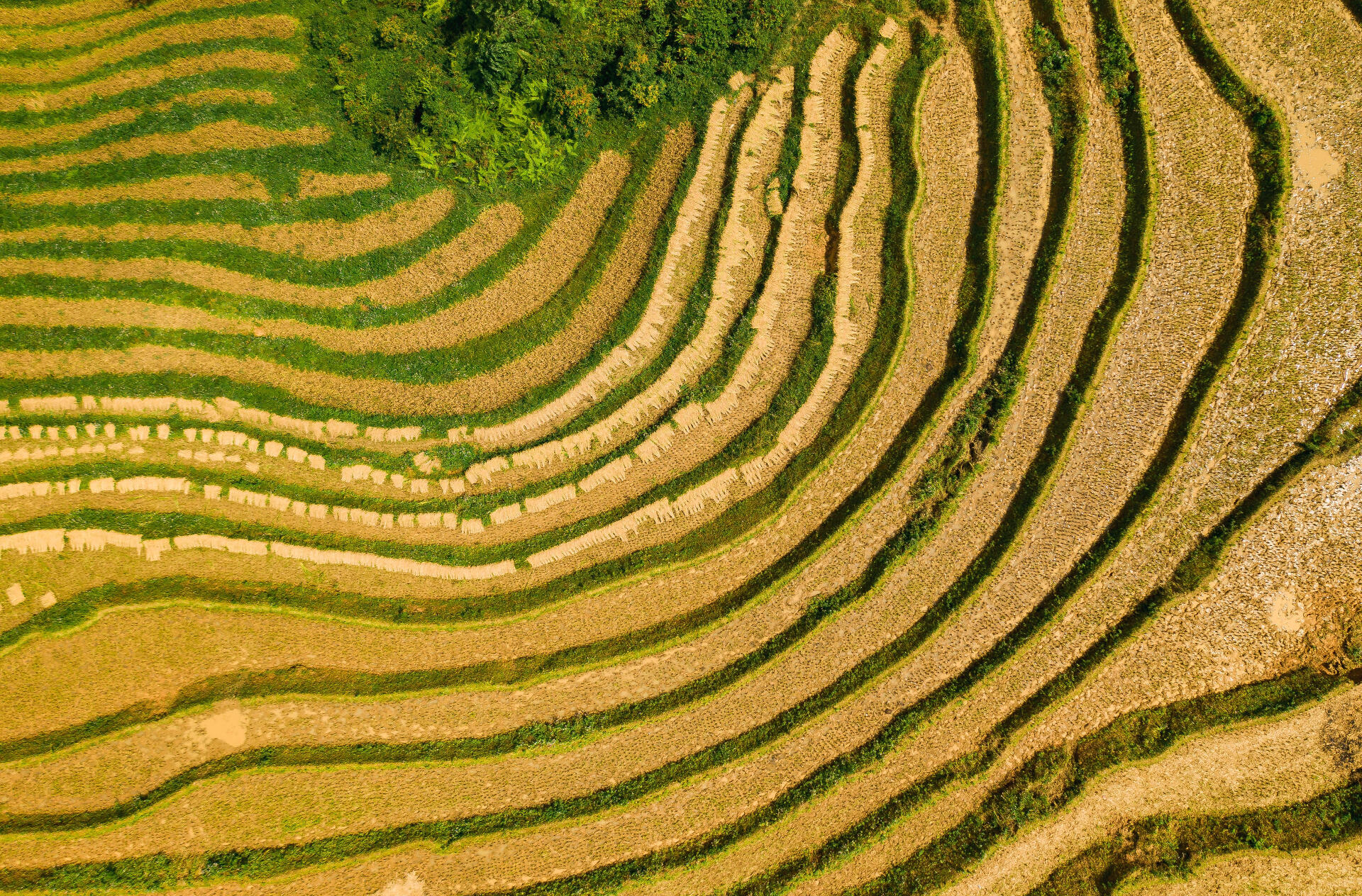
Estimated duration: 3D2NDifficulty level: 1.5 out of 5 starsOne of the best traditional homestays in the region has to be Sapa! Trudging through paddy fields and different villages in the valleys is truly an experience. Highly recommend a 4D3N stay with the locals and experience the Sapa Hospitality. Trekking here does not high level of fitness and we recommend visiting during winter if you prefer the cooler weather, but fall and summer if you prefer the green sceneries.Footprints: 3-5 Dec 2016, 11-13 July 2016
Laos
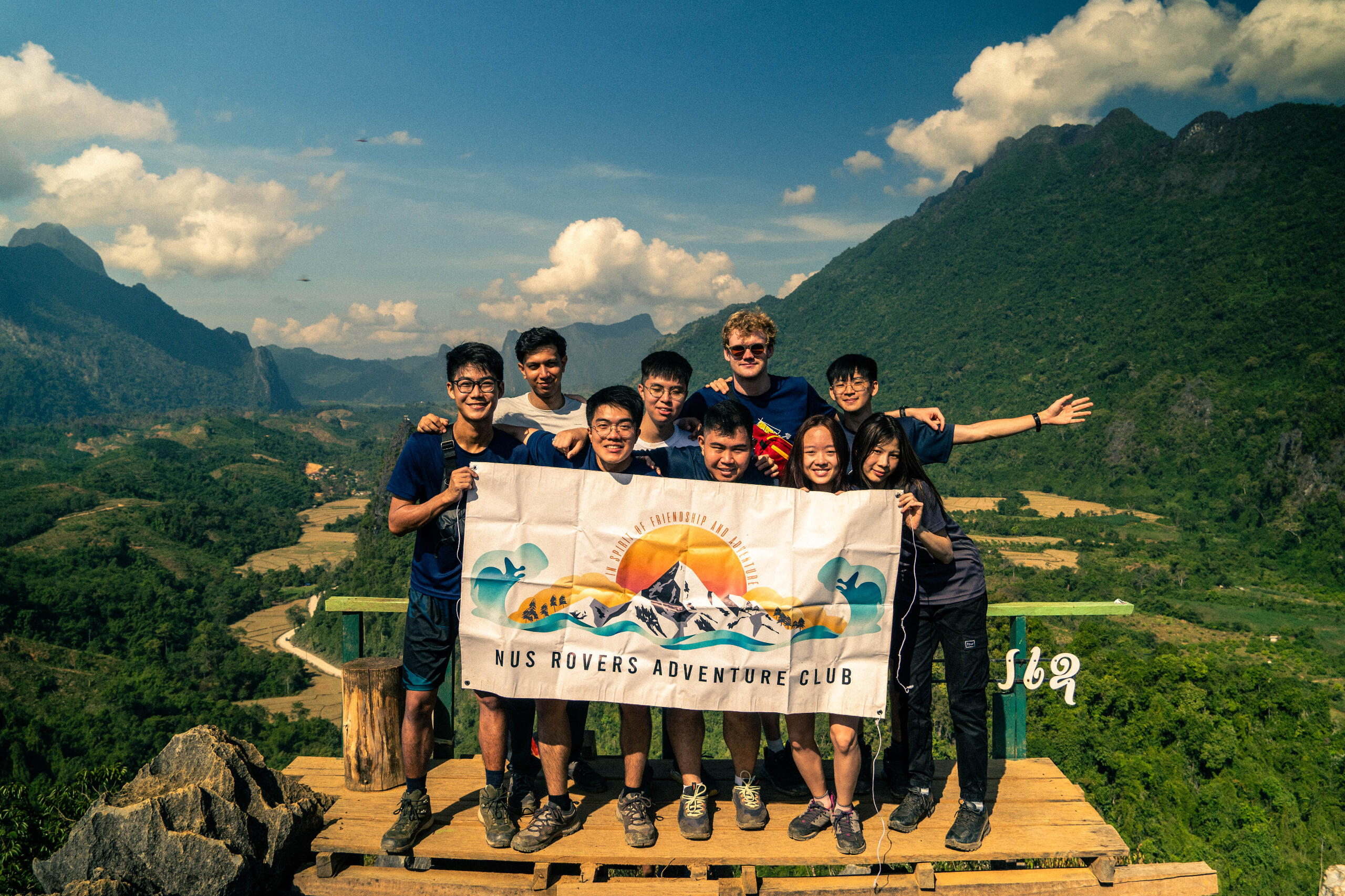
Nam Xay
Estimated duration: 2 hours
Difficulty level: 1.5 out of 5 starsWhile short, Nam Xay Viewpoint is nonetheless an unforgettable trek. While the trek is non-technical, rocks that jut out from the ground and a steeper ascent near the summit required us to use both hands and feet before reaching the top. The fun and challenging exercise made the view at the top at the summit all the sweeter! We were greeted with a generous near-panoramic view at the top of the surrounding mountains and forests, a sight that we all wholeheartedly took in.Footprints: 14 Dec 2023
Nong Khiaw
Estimated duration: 1DDifficulty level: 1.5 out of 5 starsEscape the conventional tourist paths and delve into the enchanting beauty of Nong Khiaw, Laos. Often overlooked, this hidden gem promises an extraordinary trekking adventure through its pristine landscapes. Though lesser-known, Nong Khiaw is a destination not to be missed for those seeking a blend of moderate to challenging trekking experiences. Nong Khiaw remains off the beaten trail, offering an authentic and less-explored trekking experience. Navigate through muddy paths that wind through dense jungles and ascend rocky ridgelines, immersing yourself in the untouched beauty of Laos' northern highlands.Footprints: 11 Dec 2023
Hongkong
Thousand Island Hike + Sweet Gum Forest
Estimated Duration: 2.5hDifficulty Level: 2/10We spent a day trekking two of Hong Kong’s most scenic nature spots. First, the Thousand Island Lake trail in Tai Lam brought us sweeping views of emerald islets dotting the reservoir — a calm and green escape through forested paths and dam-side ridges. In the afternoon, we wandered through Sweet Gum Forest in Tai Tong. The total estimated distance is around 6km.Footprints: 9 Jan 2025
MACLEHOSE TRAIL SECTION 2
Estimated duration: 8 hours
Difficulty level: 3/10The trek was slightly challenging with countless steps to be climbed and continuous elevation changes. It was tough, but absolutely worth the effort! We saw the captivating views of the Po Pin Chau - which were hexagonal rock columns. Additionally, we also saw breathtaking views of the blue sea, golden beaches, and a stunning sunset.During the trek, we helped each other through difficult parts of the trail and encouraged each other when the stairs were steep and endless.One unforgettable moment was walking along the road for an hour at night, heading to the bus station under the moonlight. It was a long, cold and tiring walk. We shared our snacks and bread supply, to keep each other energised for the final trek home. Despite all these challenges, all the participants stayed positive and optimistic after the demanding trek.Footprints: 7 Jan 2025
Dragon's back
Estimated Duration: 5 hoursTrek difficulty: 3/10
The trek took us through the ridges of the mountain, which looked like a Dragon’s back. We also climbed many stairs and trekked through different terrains. Eventually, we were greeted with beautiful coastal views and paragliders. We also stopped for our lunch break at a viewpoint - admiring the scenery while munching on yummy polo buns and egg tarts! After fuelling up, we continued trekking and ended at the Big Wave Bay, which was the final point of the first hike. We chilled at the beach, took many pictures, and left Rovers' mark at the sandy shores.
Footprints: 6 Jan 2025
Taiwan
Hehuanshan
Estimated Duration: 2 hoursDifficulty Level: 5/10Our first climb was Hehuan East Peak. Once again, we were met at the summit by dense fog and little visibility, but by now we had learned to embrace the mystery of the mountains. As we descended, the clouds began to lift, revealing stunning views we hadn’t dared to hope for.Next up was Hehuan Jianshan. Unlike the previous path, this one was rugged and steep, with slippery stone steps and ropes to aid our climb. It was tough, but the sense of accomplishment and the clearer skies made it worthwhile.Originally, this was supposed to be the end of our hiking for the day. However, our guide advised us to squeeze in another peak while the weather held as the weather forecast showed high chances of thunderstorms for the second day of our hike. Off we went to conquer Shimenshan, our third peak in a day.Footprints: 27 May 2025
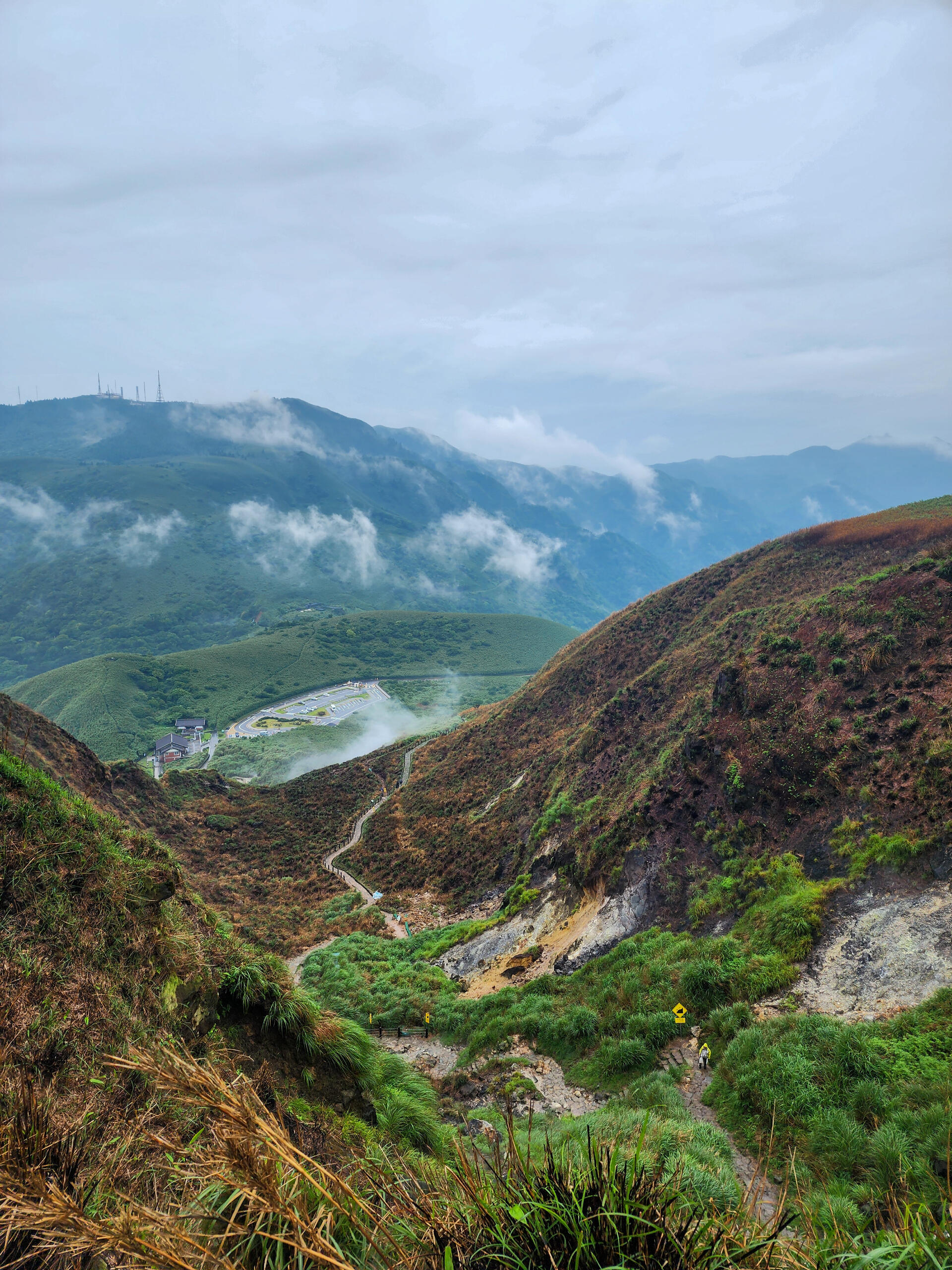
Yangmingshan/Mt. qixing
Estimated Duration: 3.5 hoursDifficulty Level: 6/10When we arrived at the Mt. Qixing trailhead, it was drizzling but we pressed on undeterred.The first ten minutes were already brutal. Steep staircases and relentless rain had our legs begging for mercy. As we ascended, mist began to wrap around the mountain, slowly swallowing the views. By the time we reached the peak, we were surrounded by nothing but a white wall of fog. All that greeted us was a wooden post marking the summit. Our descent took us toward Xiaoyoukeng, a post-volcanic landscape dotted with steaming fumaroles and sulfur vents. Even before we saw them, we could already smell it from far. The strong scent of sulfur was impossible to miss, but it only added to the experience at Taiwan’s tallest dormant volcano. We gave this trek a slightly higher rating due to the poor weather conditions faced during our trek.Footprints: 25 May 2025
ChiaMing Lake
Estimated duration: 3D2N
Difficulty level: 5 out of 5 starsChiaming Lake in Taiwan is a hidden gem nestled amidst the majestic mountains. Despite its remote location in Chi Shang, the trek offers challenge suitable for adventurous souls. As you ascend to the lake, be prepared for breathtaking vistas and serene landscapes awaiting at every turn. Spend nights under the starry sky, surrounded by the tranquility of the wilderness. Despite the cold, the stunning beauty of the landscape, coupled with the warmth of camaraderie, creates unforgettable memories in the midst of nature's icy embrace. Chiaming Lake promises an unforgettable journey for those seeking a true escape into nature's embrace.Footprints: 3-5 Jan 2024
Japan
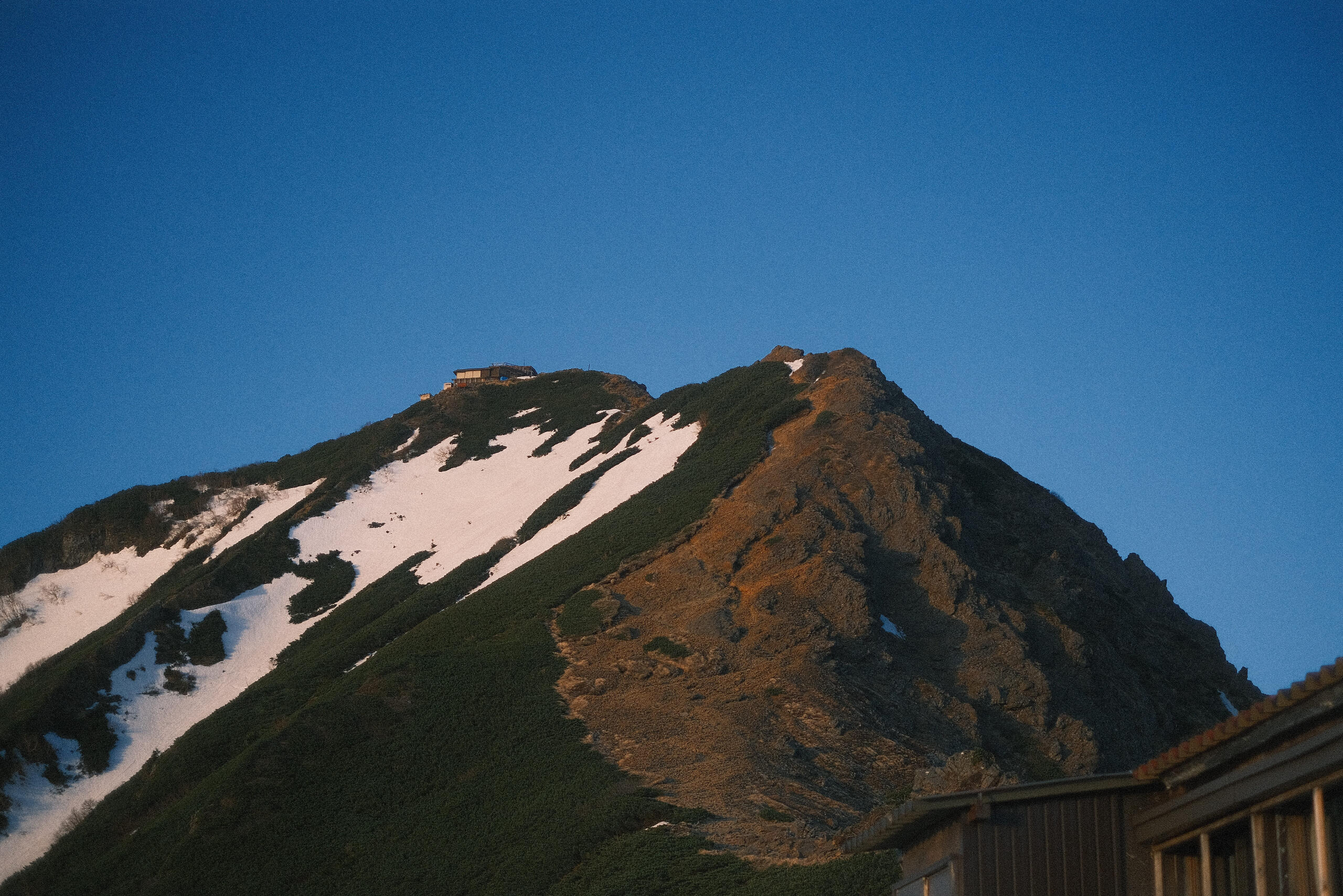
Mount Takao
Estimated Duration: 3.5 hoursDiffuculty Level: 3/10Footprints: 27 May 2025
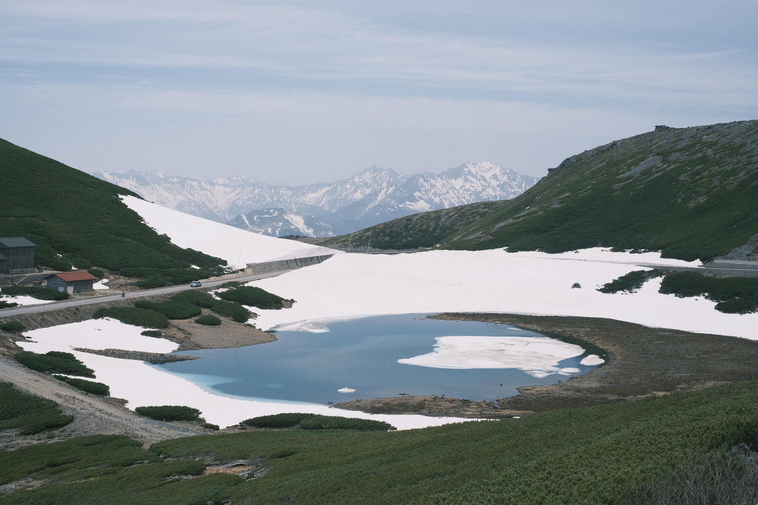
Mount Norikura
Estimated Duration: 4 hoursDifficulty Level: 5/10Footprints: 23 May 2025
Mount Akadake
Estimated Duration: 2D1NDifficulty Level: 6/10Footprints: 21-22 May 2025